Prev Post
Understanding Vahivat (Vahiwat) in Indian Land RecordsPCMC to Publish Red-Zone Map Around Defence Establishments — Relief for 4,000 Property Owners Soon
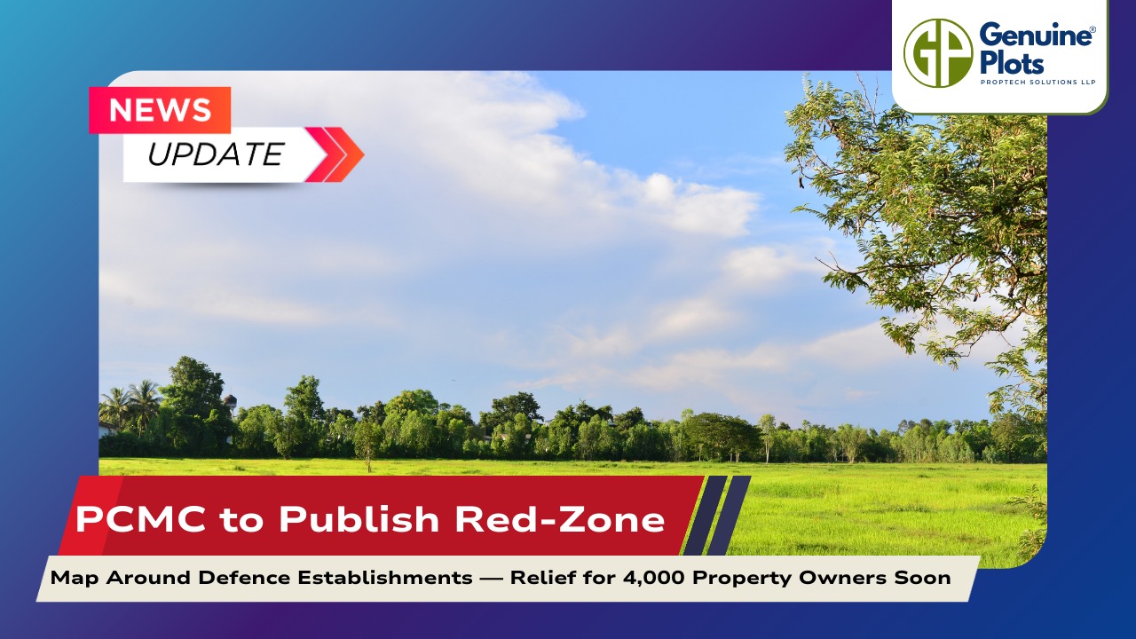
The PCMC is set to release an official “red-zone” map next week, which will clearly demarcate areas around two sensitive defence establishments — the Ordnance Factory Dehu Road (ammunition depot) and the Dighi Magazine Depot — where construction and development will be prohibited under the Works of Defence Act, 1903.
What is the Red Zone and Why It Matters
Under the proposed plan:
- A 2,000-yard radius around the Dehu Road ordnance depot.
- A 1,200-yard radius around the Dighi Magazine Depot.
Inside these zones, construction and new development will be prohibited — a regulation meant to uphold security and safety around defence assets.
Who Will Be Affected
The red-zone designation is expected to directly impact around 4,000 properties — both residential and commercial — that currently fall within the buffer zones of these depots.
Localities likely to be affected include (but are not limited to) Talawade, Nigdi, Ravet, Chikhali, Dighi, Bhosari, Yamuna Nagar, Rupi Nagar, Vadmukhwadi, and Bopkhel, among others.
For many residents and property owners, the new map brings long-awaited clarity. With unclear boundaries until now, there has been persistent confusion and concern over legal construction permissions.
Why the Map Was Needed
The process to draw accurate red-zone boundaries began after the state’s land-records department conducted a survey, employing satellite imagery to map the zones. The exercise was completed recently, and PCMC has spent over ₹1.13 crore for land measurement and mapping for the Dehu Road and Dighi areas.
The updated map was submitted to PCMC on 31 July 2025, according to civic-body officials.
However, publication has been delayed because the map must first be vetted by the defence authorities to ensure that no sensitive installations are exposed publicly.
What This Means for Residents and Property Owners
Once released, the map will:
- Clearly inform which properties lie inside the red zone (where construction is prohibited) and which lie outside (eligible for development).
- Provide long-awaited clarity for home-buyers, developers, and existing residents — helping avoid legal disputes over building permissions.
- Help civic authorities regulate illegal or unauthorised constructions that have proliferated over the decades due to boundary ambiguity.
An official from PCMC’s Town Planning Department, Kishor Gokhale, stated that the map has already been shared with defence authorities and they expect to receive a response within “the next four to five days,” after which the map will be made public.
Source- TOI
Is Buying a Plot in New Chandigarh Better Than Flats? Complete Comparison
Is land investment in Chandigarh better than buying flats?
Yes, land investment in Chandigarh—especially in New Chandigarh—offers higher long-term appreciation compared to flats. While flats provide immediate usability, residential plots in Chandigarh tend to generate better returns over 5–10 years.
Are residential plots in Chandigarh a good long-term investment?
Absolutely, residential plots in Chandigarh are ideal for long-term investors due to increasing land scarcity and infrastructure growth. Areas like Mullanpur are seeing strong demand for land investment in Chandigarh.
What are the advantages of buying flats in New Chandigarh?
Flats in New Chandigarh offer ready-to-move options, modern amenities, security, and rental income potential. They are suitable for end-users or those seeking hassle-free living.
Why are GMADA plots in New Chandigarh popular among investors?
GMADA plots in New Chandigarh are government-approved, ensuring clear titles and planned infrastructure. This makes them a secure choice for land investment in Chandigarh with strong appreciation potential.
Is New Chandigarh suitable for NRI investment?
Yes, NRI investment in New Chandigarh is growing due to its planned development, proximity to Chandigarh city, and availability of both flats and plots. NRIs often prefer residential plots in Chandigarh for long-term wealth creation.
Which is better for rental income: flats or plots in New Chandigarh?
For immediate rental returns, flats in New Chandigarh are a better option. However, for capital growth, land investment in Chandigarh through plots typically delivers higher long-term gains.
Is HSVP plot investment a good decision in 2026?
Yes, HSVP plot investment in 2026 is considered a strong long-term option due to government-backed security, planned infrastructure, and new sector launches in Gurugram and Faridabad, boosting property investment in Haryana.
Why are plots for sale in Haryana gaining popularity?
Plots for sale in Haryana are in high demand due to rapid urban development, improved connectivity (Dwarka Expressway, Sohna Road), and the availability of planned layouts under HSVP, making them ideal for both investors and end-users.
What is the HSVP registration process for buying plots?
The HSVP registration process involves registering on the official e-Bhoomi portal, completing KYC, submitting required documents, and participating in e-auctions or allotment schemes for plots for sale in Haryana.
Which locations are best for property investment in Haryana through HSVP?
Top locations for property investment in Haryana include Gurugram, New Gurgaon, Sohna, and Faridabad. These areas are emerging growth corridors with high appreciation potential for HSVP plot investment.
What are the risks involved in HSVP plot investment?
While HSVP plot investment is secure, buyers should consider potential delays in infrastructure development, high entry costs in prime sectors, and the need for a long-term investment horizon.
Is HSVP suitable for short-term or long-term investment?
Property investment in Haryana through HSVP is best suited for long-term investors (5–10 years). While appreciation is strong, short-term gains may be limited in newly developing sectors.
How can I apply the HSVP plot online in 2026?
To apply HSVP plot online, visit the official HSVP e-Bhoomi portal, complete the registration process, upload KYC documents, and participate in the e-auction or allotment scheme. The online system makes HSVP plot investment and buying plots for sale in Haryana more transparent and convenient for buyers.
What are the GMADA auction dates for 2026?
The GMADA auction dates for 2026 are scheduled from January 14, 2026, to February 11, 2026. During this period, buyers can bid for premium plots in Mohali and New Chandigarh through the official online portal.
What is the GMADA e-auction process?
The GMADA e-auction process is a transparent online system where buyers register on the portal, submit documents, pay an eligibility fee, and participate in live bidding for plots for sale in Mohali.
How to buy a GMADA plot through e-auction?
To understand how to buy a GMADA plot, follow these steps:
- Register on the GMADA portal
- Complete KYC and documentation
- Pay the eligibility fee
- Participate in the online bidding
- Pay 25% after winning the bid, and the remaining amount within the given timeline
What types of plots are available in the GMADA e-auction 2026?
The auction includes residential, commercial, institutional, and group housing plots in Mohali, along with premium sites in areas like Eco City-2 in New Chandigarh.
Are plots for sale in Mohali through GMADA a good investment?
Yes, plots for sale in Mohali via GMADA are considered a secure investment due to government backing, clear titles, and high appreciation potential in well-developed sectors.
What should buyers check before participating in the GMADA e-auction process?
Before entering the GMADA e-auction process, buyers should verify property details, check financial readiness, review eligibility criteria, and inspect the site location to make an informed decision when buying plots in Mohali.
Plots for Sale in Nellore: Price Trends, Locations & Investment Guide 2026

What is the current price trend for plots in Nellore?
The Nellore plots price varies widely depending on location, ranging from approximately ₹500 to ₹3,500 per sq. ft., with overall plot prices between ₹10 lakh to ₹2.5 crore. Affordable open plots in Nellore are still available in developing areas, while prime locations command higher rates.
Are residential plots in Nellore a good investment in 2026?
Yes, residential plots in Nellore are gaining popularity due to steady infrastructure growth and affordability compared to metro cities. Increasing demand for land and limited supply in prime areas is driving long-term appreciation.
Which locations are best for buying land for sale in Nellore?
Popular areas for land for sale in Nellore include Dhanalakshmi Puram, Vedayapalem, Kakupalli, and regions along Mypadu Road. These areas offer a mix of affordability, connectivity, and future growth potential.
What factors influence plots for sale in Nellore prices?
The price of plots for sale in Nellore depends on:
- Location and proximity to highways or city center
- Availability of infrastructure (roads, drainage, water)
- Layout approvals (DTCP/RERA)
- Plot size and facing
Well-developed layouts with amenities usually have higher Nellore plots price.
What should buyers check before investing in open plots in Nellore?
Before purchasing open plots in Nellore, ensure:
- Clear land title and legal approvals
- Proper road access and infrastructure
- Future development plans nearby
- Availability of basic utilities
These checks help secure a safe investment in residential plots in Nellore.
Is now the right time to buy plots for sale in Nellore?
Yes, 2026 is considered a good time to invest in plots for sale in Nellore, as prices are still relatively affordable compared to larger cities. With ongoing development and increasing demand, land for sale in Nellore offers strong future appreciation potential.
Plots for Sale in Nellore: Price Trends, Locations & Investment Guide 2026
What is the current price trend for plots in Nellore?
The Nellore plots price varies widely depending on location, ranging from approximately ₹500 to ₹3,500 per sq. ft., with overall plot prices between ₹10 lakh to ₹2.5 crore. Affordable open plots in Nellore are still available in developing areas, while prime locations command higher rates.
Are residential plots in Nellore a good investment in 2026?
Yes, residential plots in Nellore are gaining popularity due to steady infrastructure growth and affordability compared to metro cities. Increasing demand for land and limited supply in prime areas is driving long-term appreciation.
Which locations are best for buying land for sale in Nellore?
Popular areas for land for sale in Nellore include Dhanalakshmi Puram, Vedayapalem, Kakupalli, and regions along Mypadu Road. These areas offer a mix of affordability, connectivity, and future growth potential.
What factors influence plots for sale in Nellore prices?
The price of plots for sale in Nellore depends on:
- Location and proximity to highways or city center
- Availability of infrastructure (roads, drainage, water)
- Layout approvals (DTCP/RERA)
- Plot size and facing
Well-developed layouts with amenities usually have higher Nellore plots price.
What should buyers check before investing in open plots in Nellore?
Before purchasing open plots in Nellore, ensure:
- Clear land title and legal approvals
- Proper road access and infrastructure
- Future development plans nearby
- Availability of basic utilities
These checks help secure a safe investment in residential plots in Nellore.
Is now the right time to buy plots for sale in Nellore?
Yes, 2026 is considered a good time to invest in plots for sale in Nellore, as prices are still relatively affordable compared to larger cities. With ongoing development and increasing demand, land for sale in Nellore offers strong future appreciation potential.
Recent Posts
Tags
Bhunaksha,
genuine plots,
Land For Sale,
Maharashtra Bhunaksha,
plots for sale,
Gunthewari,
Gunthewari Land,
Gunthewari Rules,
Extract Documents,
Plots and Lands,
Saat Baara,
Extract Saat,
Baara Utara,
Jamabandi,
property tax payments,
Gram Panchayat,
lower prices,
non-agricultural land,
Lower Investment Cost,
Gram Panchayat lands,
Fresh Land Settlements,
Growing demand,
affordable homes,
genuine p,
legal Land,
bungalow plots,
Konkan,
Maharashtra,
Purandar,
Pune,
Karnataka,
Bangalore,
Farm Land,
Kolkata,
Rajarhat,
Indore,
Chhatrapati Sambhajinagar,
Aurangabad,
Mundhwa,
Agricultural Land,
Farmhouse Plot,
Rules And Penalties,
Residential Plots,
NA PLots,
Residential NA Plots,
Commercial NA Plots,
Animal Husbandry Land,
Tathawade,
Vahivat Land Maps,
Vahivat,
Indian Land Records,
Ownership Rights,
Red zone,
PCMC,
Dehu Road,
Land Registration Rules,
Land Investing,
Infrastructure Growth,
Land Ownership,
Land Encroachment,
Panshet Dam,
Varasgaon Dam,
Verified Land,
Plot For Sale,
Land Investment,
Verified Plots,
Land Acquisiton,
Hydrological Survey,
Invest In Land,
Verified Land Plots,
Panshet,
Khadakwasla,
Land Rules,
Dakhil Kharij,
Land Registry,
Property Onwership,
Clean Title Check List,
Property Verification,
Digital Registry,
Farm Plots,
Agro Property,
Land Value Growth,
Urban Expansion,
Senapati Bapat Road,
Registered Land,
Agricultral Plot,
Purandar Airport,
Safe Investment,
Secure Property,
Plot Buyers,
Approved Plots,
Land ROI,
NA Approved Plots,
NA Land,
Welspun One,
Logistic Park,
Talegaon,
PMC Bharat Mandapam,
Urban Development,
Lohgaon,
Close To Nature,
Gated Community Plots,
Buy Land VS Gold Investment,
NRI Investment,
Future Ready Living,
Trusted Plots,
Plot Investment,
Authentic Land,
Safe Land Buying,
Mumbai,
Premium Plots,
MMR Land Investment,
MMR Infrastructure,
Metro Connectivity,
Plots in Mahabaleshwar hill station investment,
Mahabaleshwar land prices and future growth,
Scenic residential plots in Mahabaleshwar,
Mumbai 3.0,
Mumbai 3.0 vs Mumbai 2.0,
Mumbai property investment,
Real estate investment in Mumbai,
Upcoming residential projects in Mumbai,
CIDCO plot auctions,
CIDCO auction Navi Mumbai,
Upcoming CIDCO plot auctions 2026,
CIDCO land auction dates,
Navi Mumbai plot auctions,
CIDCO plots in Navi Mumbai,
CIDCO plots in Kharghar,
CIDCO plots in Ulwe,
NMIA investment opportunities,
Mumbai 3.0 plotted development,
Mumbai 3.0 real estate,
Plots in Mumbai 3.0,
Land investment in Maharashtra,
Residential plots near Mumbai,
Land appreciation in Mumbai 3.0,
Residential land for sale in Mumbai 3.0,
Altamura NA Plots,
Altamura Nadar City,
NA Plots in Nadar City,
Nadar City Plots,
Plots in Nadar City,
YEIDA plots,
YEIDA plots near Noida Airport,
Noida Airport plots,
Jewar Airport investment,
Yamuna Expressway plots,
YEIDA plot scheme 2026,
Noida Airport real estate,
Zepto,
Zepto effect,
D2C brands India,
Urban consumer trends,
Marketplace evolution,
Urban infrastructure growth,
YEIDA Residential Plot Scheme,
Yamuna Expressway Plot Scheme,
YEIDA Residential Plots,
Yamuna Expressway Authority,
Noida Investment,
Residential Plots in Lucknow,
LDA Plots in Lucknow,
Lucknow Real Estate,
LDA Approved Plots,
Plots for Sale in Lucknow,
Lucknow Property Investment,
Land Investment in Lucknow,
Residential Land in Lucknow,
Buy Plot in Lucknow,
Lucknow Development Authority,
Maharashtra Fragmentation Law 2025,
Fragmentation Act Maharashtra,
Maharashtra land law update 2025,
Maharashtra land reforms 2025,
Land subdivision rules Maharashtra,
Maharashtra agriculture land purchase rules,
Agricultural land purchase restrictions Maharashtra,
Can non-farmers buy agricultural land in Maharashtra,
NA conversion process Maharashtra,
Collector permission for land purchase,
farmland prices in Nagpur,
agricultural land price in Nagpur per acre,
farmland cost in Nagpur Maharashtra,
Nagpur agricultural land investment,
per acre agricultural land rate in Nagpur,
Tukdebandi Law Maharashtra,
Maharashtra Fragmentation Act update,
Land subdivision law Maharashtra,
Agricultural land division Maharashtra,
Maharashtra land reform ordinance,
Plot registration Maharashtra,
Farmland prices Nagpur,
Nagpur agricultural land rates,
Farmland per acre Maharashtra,
Agricultural land price Nagpur,
Farm land cost Nagpur,
Nagpur real estate trends,
Land investment Nagpur,
Avani Farms,
Avani Farms Pune,
Farmland near Pune,
Farm plots for sale,
Agricultural land investment,
Gated farmland near Pune,
NRI agricultural land rules India,
Can NRI buy agricultural land in India,
FEMA rules for NRI property purchase,
RBI guidelines for NRI land investment,
NRI farmland investment India,
Agricultural land purchase by NRI,
Maharashtra Fragmentation Act,
Minimum plot size in Maharashtra,
Guntha rules Maharashtra,
Agricultural land division rules,
Minimum land area for sale in Maharashtra,
Legal plot size in guntha,
Guntha conversion rules,
NRI land purchase in India,
Can NRIs buy agricultural land in India,
NRI property investment India,
NRI buying residential land,
NRI real estate guidelines India,
Investment tips for NRIs in India,
Mutation Entry Process,
Land Mutation in India,
Property Mutation Process,
Land Ownership Transfer,
1 guntha na plot prices in pune 2026,
1 guntha plot price in pune,
na plots in pune,
residential na plots pune,
guntha plot rate in pune,
na plot investment in pune,
plots near purandar airport,
1 Acre Land Price in Pune,
Pune Land Rates 2025,
Pune Land Price 2026,
Pune Acre Land Cost,
Land Value Pune,
Agricultural Land Price Pune,
gated community plots in Hinjewadi,
Hinjewadi plots for sale,
residential plots in Hinjewadi Pune,
premium plots in Hinjewadi,
plots near Rajiv Gandhi Infotech Park,
land for sale in Hinjewadi Pune,
Pune property investment,
plots for sale in Pune below 5 lakhs,
Pune rural land investment,
gated plotting projects Pune,
MIDC growth corridor plots,
Residential plots for sale in Hinjewadi,
Plots in Hinjewadi Pune,
Land for sale in Hinjewadi,
Residential NA plots Hinjewadi,
Hinjewadi real estate trends 2026,
Nashik land investment,
Trimbakeshwar land for sale,
Simhastha Kumbh 2026,
Simhastha Kumbh 2027 real estate impact,
Trimbakeshwar property investment,
Land appreciation in Nashik,
plots for sale in pune,
types of plots in pune,
residential plots in pune,
agricultural land in pune,
villa plots in pune,
NRI agricultural land purchase India,
NRI property investment in India,
Agricultural land rules for NRIs,
NRI real estate investment India,
NA plot meaning,
what is NA land,
NA land in Maharashtra,
land investment guide,
NRI agricultural land in Telangana,
Telangana land laws for NRI,
Telangana real estate laws,
NRI investment guide Telangana,
Legal compliance for NRI property,
NRI farmhouse purchase India,
RBI guidelines for NRI property,
NRI land buying rules,
Godham Eco Village,
Godham Eco Village for NRIs,
NRI land investment in India,
Investment plots for NRIs,
Secure land investment India,
NRI property buying guide,
plots in Pune,
NRI buying property in India,
NRI guide to buying land in Pune,
NRI land investment in Pune,
NRI property documents checklist,
Maharashtra land reform 2025,
Maharashtra land laws update,
Agricultural land rules in Maharashtra,
Buying agricultural land in Maharashtra,
Non-agricultural land conversion Maharashtra,
Maharashtra agricultural land rules 2024,
agricultural land purchase in Maharashtra,
non agriculturist land purchase rules,
who can buy agricultural land in Maharashtra,
Maharashtra land laws for non farmers,
Guntha based land rules,
Minimum guntha rule Maharashtra,
Maharashtra land laws,
Maharashtra agricultural land laws,
farmland investment Maharashtra,
buying farmland legally in Maharashtra,
NA conversion rules Maharashtra,
agricultural land eligibility criteria,
Property Mutation in India,
Land Record Update,
Revenue Records,
Property Ownership Transfer,
Mutation of Property,
Farmhouse Plots Near Pune,
NRI Investment in Pune,
Pune Real Estate,
Plots for Sale Near Pune,
Luxury Farmhouse Plots,
Pune plot scams,
Plot buying checklist,
Legal verification for plots,
NA plot verification,
Plot buying tips Pune,
Godrej Properties,
Evora Estate Panipat,
Luxury plots in Panipat,
Premium land investment,
Residential plots in Panipat,
Lodha Developers,
Lodha Developers Q3 acquisition,
Lodha land parcels Q3,
Indian real estate news,
New residential projects India,
Real estate investment news,
Premium housing projects,
Srijan Group,
Kolkata Tech Park,
Commercial Real Estate,
Real Estate Investment,
Real Estate Deal News,
NRI investment in India,
NRI land investment,
Plots for sale in India,
NRI property investment,
Can NRI buy residential plot in India,
NRI land purchase rules,
Residential plots for NRIs,
NRI real estate investment,
NRIs buying property in India,
Can NRIs buy plots in India 2026,
RBI rules for NRI property purchase,
NRI land investment rules,
MMR 3.0,
MMR real estate 2026,
Mumbai real estate market,
Navi Mumbai investment,
Thane property market,
Mumbai property trends 2026,
Land investment in MMR,
Mumbai smart city project,
Korea Mumbai partnership,
MMRDA infrastructure projects,
Korean investment in India,
MMR GDP growth,
MMR economic roadmap 2030,
Mumbai real estate,
Public private partnership projects Mumbai,
Investment opportunities in MMR,
Mumbai Metropolitan Region,
Mumbai urban development,
MMR 2047 vision,
Mumbai infrastructure projects,
Navi Mumbai development,
Goa property investment,
Invest in Goa 2026,
Goa real estate market 2026,
Best places to invest in Goa,
North Goa property,
Property appreciation in Goa,
Goa plots for sale,
Commercial property in Goa,
Buy property in Goa,
YEIDA plots 2026,
Residential plots in YEIDA,
YEIDA new scheme update,
Plots near Noida International Airport,
Yamuna Expressway Authority plots,
YEIDA housing scheme details,
Lucknow land investment,
Property in Lucknow,
Buy plots in Lucknow,
Nashik plots for sale,
Kumbh Mela 2026 Nashik,
Land investment in Nashik,
Nashik property market 2026,
Plots near Kumbh Mela Nashik,
Residential plots in Nashik,
Upcoming projects in Nashik,
Property appreciation in Nashik,
Maharashtra land investment,
Nashik Kumbh Mela 2026,
Kumbh Mela investment opportunities,
Infrastructure development in Nashik,
Plots near Nashik Kumbh Mela,
High ROI land investment,
MIHAN,
MIHAN Nagpur,
Nagpur Real Estate,
Agricultural Land Nagpur,
Nagpur Property,
Plots Near In MIHAN,
Pune residential plots,
best areas to buy plots in Pune,
Pune land investment,
investment plots in Pune,
buy land in Pune,
real estate investment in Pune,
Godrej Plots Doddaballapur,
Doddaballapur plots for sale,
Plots in North Bangalore,
Godrej Properties plots,
Residential plots in Doddaballapur,
Investment plots near Bangalore,
Gated community plots Bangalore,
Premium plots in Doddaballapur,
plots in Mahabaleshwar,
Mahabaleshwar villa plots,
farmhouse plots in Mahabaleshwar,
land for sale in Mahabaleshwar,
bungalow plots in Mahabaleshwar,
hill station property investment,
agricultural land in Mahabaleshwar,
premium land in Mahabaleshwar,
Plots in Pune under 3 lakhs for sale,
Budget residential plots near Pune,
Low cost plots near Pune highway connectivity,
plots in Pune under 3 lakhs,
farmland plots near Pune city,
Investment plots near Pune under budget,
Residential land near Pune,
Godrej plots in Pune,
Premium plotted development by Godrej in Pune,
Residential land for sale by Godrej,
Premium plot by Godrej,
Plots for sale in Hadapsar Pune,
Residential plots in Hadapsar,
Investment plots in Hadapsar,
Gated community plots in Hadapsar,
Ready to build plots in Hadapsar,
1 Guntha plot in Pune,
1 Guntha plot in Pune for sale,
1 Guntha plots near Pune city,
Residential 1 Guntha land in Pune,
Clear title 1 Guntha plot in Pune,
1 guntha plot price in village,
village plot rate per guntha,
affordable 1 guntha land in rural area,
residential plot in village Pune,
farmland plot price per guntha,
Residential 1 Guntha plot near Pune city,
Investment plots in Pune 1 Guntha,
Clear title 1 Guntha land in Pune,
Agricultural 1 Guntha plot near Pune,
1 Guntha plot in Pune Katraj for sale,
Residential plot in Katraj Pune 1 Guntha,
Katraj Pune land for home construction,
1 Guntha NA plot in Katraj Pune,
Pune Katraj plot near highway connectivity,
Gated plot project in Katraj Pune,
NA plots in Pune under 10 lakhs,
Affordable NA plots near Pune city,
NA residential plots in Pune,
NA approved plots in Pune under 10 lakhs,
Investment plots in Pune under 10 lakhs,
Residential NA plots near Pune highway,
Best plots in Pune below 10 lakhs,
Premium villa plots in Pune,
Residential villa plots in Pune near city outskirts,
Luxury villa plots in Pune,
Gated villa plot project in Pune,
Villa plot site visit in Pune,
NA plots in Pimpri Chinchwad for sale,
Residential NA plots in PCMC area,
NA approved plots in Pimpri Chinchwad,
NA land with clear title in PCMC,
NA plots near Pune Mumbai Highway PCMC,
Godrej Villa Plots Doddaballapur,
Godrej plotted development Bangalore,
villa plots in North Bangalore,
premium villa plots Bangalore,
Godrej Properties plots Bangalore,
Brigade Plots Malur,
Brigade Malur plots,
plots in Malur East Bangalore,
investment plots in East Bangalore,
residential plots in Malur Bangalore,
Brigade Group plots Bangalore,
land investment in East Bangalore,
gated community plots in Malur,
prestige plots devanahalli,
prestige plots in devanahalli bangalore,
plots for sale in devanahalli,
prestige plots investment,
premium plots in devanahalli,
residential plots near kempegowda airport,
What is NA plot in real estate,
NA land meaning in property,
NA approved plotsDifference between NA and agricultural land,
Buying NA plots in Maharashtra,
NA plot vs agricultural land,
Plot prices in Mysore,
Mysore infrastructure projects,
Mysore property investment,
Land investment in Mysore,
Plot investment opportunities,
land buying guide in goa,
buy land in goa,
plots for sale in goa,
legal process to buy land in goa,
property in goa,
residential plots in goa,
Nashik Simhastha Kumbh Mela 2026,
Sadhugram expansion Nashik,
Maharashtra Kumbh Mela planning,
Nashik Kumbh Mela preparations,
tourism development in Nashik,
plots in Nagpur,
Nagpur plot investment,
land for sale in Nagpur,
residential plots in Nagpur,
golden rules before buying plots in Nagpur,
Nagpur land investment,
plot investment in Nagpur,
land investment in Nagpur,
plots for sale in Nagpur,
best areas to buy plots in Nagpur,
buying plots in Nagpur,
plot purchase checklist,
legal checklist for buying land,
documents required for plot purchase,
NA plots in Nagpur,
Tattvana,
Tattvana in Kamshet,
Moregaon Farmland Estates,
farmland investment Pune,
agricultural land investment,,
farmland for sale near Pune,
farm plots in Pune,
gated farmland projects,
agricultural plots Maharashtra,
open plot vs NA plot,
difference between open plot and NA plot,
what is NA plot in India,
open plot meaning in real estate,
NA land vs agricultural land,
residential NA plots benefits,
land investment in India,
buying NA plot vs open land,
capital gains on agricultural land,
rural vs urban agricultural land tax,
agricultural land tax rules India,
capital gains tax India property,
is agricultural land taxable,
rural agricultural land exemption,
urban agricultural land tax India,
Runwal Enterprises Alibaug township,
Alibaug real estate,
coastal real estate India,
township projects in Alibaug,
luxury properties in Alibaug,
Mumbai weekend homes investment,
Alibaug property investment,
isprava south goa,
ultra luxury villas in goa,
south goa real estate,
luxury homes in goa,
isprava projects goa,
premium villas in south goa,
land investment advisory services,
secure land investment,
real estate advisory services,
verified land deals,
investment plots near Pune,
land buying guide India,,
#KanpurRealEstate,
#KDAPlots,
#KanpurProperty,
#RealEstateKanpur,
#PropertyTrends,
Gokul Plots investment,,
real estate investment Gokul,,
plots with high appreciation potential,
smart land investment strategies,
plots for sale in North Bangalore,
land investment Bangalore,,
emerging areas in North Bangalore,
residential plots Bangalore,,
Bangalore real estate investment,,
North Bangalore property trends,,
plots near airport Bangalore,,
HUDA plots in Gurgaon,
HUDA plots in Faridabad,
residential plots Haryana,
HUDA approved plots,
plots for sale in Gurgaon,
plots in Faridabad investment,
Prestige Marigold plots,,
Bangalore plotted developments,
land investment Bangalore,
best plots in North Bangalore,
#PlotsForSaleInNellore,
#NelloreRealEstate,
#NellorePlots,
#RealEstate2026,
#PropertyInvestment,
#NelloreProperty,
#AndhraPradeshRealEstate,
GMADA E Auction 2026,
GMADA plots Mohali,
plots in Mohali for sale,
GMADA Mohali auction process,
buy plots in Mohali,
Punjab property investment,
GMADA scheme 2026,
Mohali real estate,
HSVP plots 2026,
HSVP plot investment,
HSVP plots Haryana,
land investment benefits,
residential plots investment,
government approved plots,
buy plot in New Chandigarh,
flats in New Chandigarh,
New Chandigarh real estate,
property investment in New Chandigarh,
residential plots in New Chandigarh,
apartments in New Chandigarh,
#WaveCityGhaziabad,
#GhaziabadPlots,
#PlotsInGhaziabad,
#NCRRealEstate,
#RealEstateInvestment,
#ResidentialPlots,
APIIC vacant plots,
APIIC plots for sale,
industrial plots in Andhra Pradesh,
commercial land for MSMEs,
startup investment plots,
APIIC industrial land,
HUDA plots,
HUDA plots investment,
property appreciation,
plot investment benefits,
high return property investment,
land appreciation,
#GDAPlotsInGhaziabad,
#PlotsForSaleInGhaziabad,
#ResidentialPlotsGhaziabad,
#InvestmentPlots,
#RealEstateGhaziabad,
#GDAApprovedPlots,
#BaliProperty,
#PropertyInBali,
#IndiansInBali,
#BaliRealEstate,
#InternationalPropertyInvestment,
buy plots in Sarjapur Road Bangalore,
plots in Sarjapur Road,
residential plots in Sarjapur Road,
land for sale in Sarjapur Road Bangalore,
investment plots in Bangalore,
plots near IT corridor Bangalore,
how Indians can buy property in Bali,
buy property in Bali for Indians,
Bali property investment,
property in Bali for Indian buyers,
Bali real estate guide,
foreign property investment Bali,
legal checks before buying property in Bali,
Indians invest in Bali property,
due diligence for Bali property,
Bali real estate for Indians,
Bali property legal verification,
verified farmland plots,
100% verified farmland plots,
farmland investment India,
legal farmland plots,
farmland plots for sale,
Konkan land investment,,
high-growth corridors Maharashtra,
land investment 2026,
plots for sale in Maharashtra,