Prev Post
PMRDA, District Administration Push for Land Acquisition for Nashik Phata–Khed Elevated CorridorMaharashtra to Map Subdivided Land Plots in 18 Talukas Under Pilot Project
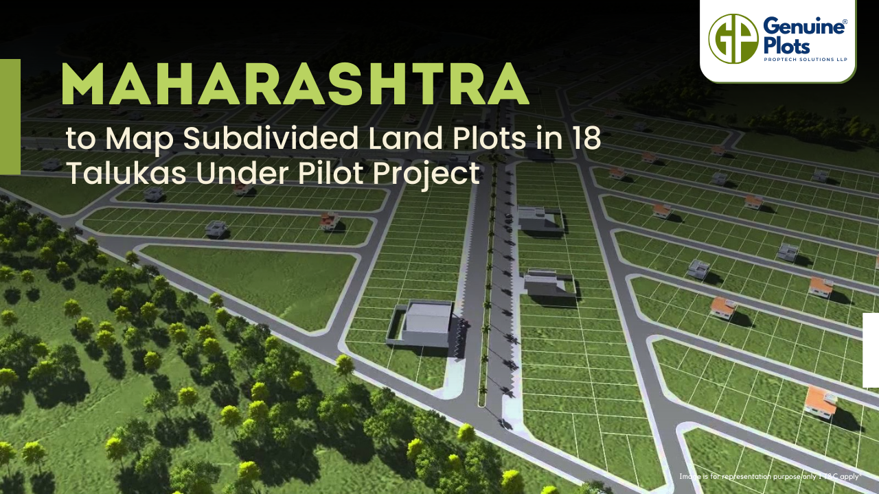
The Maharashtra Land Records Department has launched a pilot project to measure and map subdivided land plots (sub-holdings) in selected areas of the state.
Over the years, many plots have been informally subdivided, creating mismatches between the 7/12 land ownership document and official cadastral maps. The project aims to record these subdivisions accurately.
A total of 18 talukas across six revenue divisions have been chosen for the initiative, including Pune, Palghar, Raigad, Thane, Solapur, Sangli, Dhule, Jalgaon, Chandrapur, and Kolhapur.
The work will be executed by private agencies, which are currently being finalised through a tendering process.
How Upcoming Infrastructure Projects Are Impacting Plot Prices in Mysore
 - 2026-03-11T125806.623.png)
1. How are upcoming infrastructure projects impacting plots in Mysore for sale?
Upcoming infrastructure projects like the Bengaluru–Mysuru Expressway, Peripheral Ring Road (PRR), and airport expansion are directly increasing demand for plots in Mysore for sale. With travel time to Bengaluru reduced to under 90 minutes, professionals are investing in second homes and gated communities. This has led to price appreciation of 40–60% in key corridors over the past five years.
2. Why are residential plots in Mysore seeing rapid price growth in 2025?
Residential plots in Mysore are witnessing strong growth due to industrial expansion, SEZ development, and improved connectivity. The city recorded a reported 53% property price increase during 2024–2025, driven largely by infrastructure upgrades and its transformation into a satellite town of Bengaluru. Annual appreciation currently ranges between 8%–12%, with certain pockets seeing up to 18%.
3. Which areas offer the best plots in Mysore for investment?
The best plots in Mysore are located in high-growth zones such as Hootagalli, Vijayanagar 4th Stage, JP Nagar, Hebbal, and along the Bengaluru–Mysuru Highway. Areas near industrial corridors, the Infosys campus, and planned metro routes are especially attractive due to rising housing demand and strong future appreciation potential.
4. Are plots in Mysuru still affordable compared to Bengaluru?
Yes, plots in Mysuru remain 30–50% more affordable than comparable locations in Bengaluru. Despite rapid infrastructure development and rising demand, Mysore continues to offer better entry pricing, making it attractive for first-time buyers, long-term investors, and those seeking gated community developments.
5. How is the Bengaluru–Mysuru Expressway affecting affordable plots in Mysore?
The expressway has significantly increased demand for affordable plots in Mysore, particularly from Bengaluru-based buyers seeking lower prices and better lifestyle options. The improved highway connectivity, along with upcoming metro and ring road projects, has turned peripheral areas into viable residential zones, pushing plot prices upward.
6. Will metro rail connectivity increase demand for plots in Mysore?
Yes, the proposed metro expansion is expected to boost demand for residential plots in Mysore, especially in localities near planned stations such as Vijayanagar 4th Stage and along the Bengaluru–Mysore Road corridor. Historically, metro infrastructure leads to higher property values, and premium plots near transit hubs are already commanding stronger interest.

1. What is the NA plot land?
NA stands for Non-Agricultural. An NA plot is a land that has been legally converted from agricultural use to non-agricultural use, allowing it to be used for residential, commercial, or industrial purposes. Buyers can legally construct homes or buildings on NA land after obtaining necessary building approvals.
2. What is the NA plot's meaning in real estate?
The NA plots' meaning in real estate refers to plots that have received official government approval for non-agricultural usage. This conversion ensures the land complies with zoning laws and is suitable for construction, making it safer for buyers compared to agricultural land.
3. What are the NA plot benefits in real estate?
There are several NA plot benefits in real estate, including:
✔ Legal permission for construction
✔ Easier access to home loans
✔ Higher resale value
✔ Reduced legal complications
✔ Better long-term appreciation
Because NA plots are approved for development, they are considered a secure and investment-friendly option.
4. What is the NA plot approval process?
The NA plot approval process involves applying to the local revenue authority to convert agricultural land into non-agricultural land. The process includes land title verification, zoning compliance checks, payment of conversion charges, and issuance of an official NA order. Once approved, the land can legally be used for residential or commercial construction.
5. Is it safe to buy NA plot land?
Yes, buying NA plot land is generally safer than purchasing agricultural land for residential use because it already has a government-approved conversion. However, buyers should still verify title clarity, local authority permissions, layout approvals, and access to utilities before investing.
6. Why are NA plots preferred by beginners in real estate?
Beginners prefer NA plots because the NA plot benefits in real estate include legal clarity, construction flexibility, and easier resale. Since the NA plot approval process confirms permitted land use, buyers face fewer regulatory hurdles compared to agricultural land purchases.
Investment Potential: Should You Buy Prestige Plots Devanahalli Now?
 - 2026-03-11T125133.875.png)
1. Is it a good time to invest in Prestige plots in Devanahalli in 2026?
Yes, investing in Prestige plots Devanahalli in 2026 is considered a strong opportunity due to rapid infrastructure growth, metro expansion, and 20–25% annual appreciation trends. With proximity to Kempegowda International Airport and emerging IT/Aerospace hubs, Prestige plots in Devanahalli are positioned for medium-to-long-term value creation.
2. What are the price trends for plots in Devanahalli?
The current price trends for plots in Devanahalli range approximately from ₹26.66 lakh to ₹1.75 crore, depending on size and location. Due to metro expansion, ITIR development, Aerospace SEZ growth, and increasing demand near the airport corridor, prices have shown steady upward momentum with strong appreciation potential over the next few years.
3. Why are prestige plots in Devanahalli considered high-growth investments?
Prestige plots in Devanahalli benefit from the strong brand reputation of Prestige Group, known for delivering quality developments like Prestige Autumn Leaves near the airport. The confirmed Namma Metro expansion to Devanahalli in the 2025 Karnataka budget significantly boosts connectivity and future demand, making it a recommended buy for long-term investors.
4. How does Devanahalli compare to Sarjapur for plotted investments?
While Sarjapur is already a developed corridor, prestige plots Devanahalli are often preferred for long-term investment because of superior planning, large-scale infrastructure projects, and emerging economic hubs. Devanahalli offers better future growth potential due to its airport proximity, Aerospace SEZ, ITIR, and Prestige Tech Cloud Park developments.
5. What makes Prestige Gardenia Estates Devanahalli attractive to investors?
Prestige Gardenia Estates Devanahalli stands out due to structured layouts, premium plotted development standards, and the backing of Prestige Group’s credibility. Investors benefit from secure, planned community infrastructure while retaining flexibility to build customised homes in a rapidly appreciating location.
6. What is the ideal investment timeline for prestige plots in Devanahalli?
For prestige plots in Devanahalli, the ideal investment horizon is medium to long term (5–10 years). While short-term appreciation has been strong, the full impact of metro connectivity, IT/Aerospace hub expansion, and infrastructure upgrades will mature over the coming years, potentially maximising ROI.
Why Brigade Plots Malur Is the Next Hot Real Estate Investment in East Bangalore
 - 2026-03-11T124601.077.png)
1. Why are Brigade Plots Malur considered the next big investment opportunity in East Bangalore?
Brigade Plots Malur are emerging as a prime investment hotspot because of their strategic location near the KIADB industrial hub, strong infrastructure growth, and rising housing demand. With connectivity through the Chennai Expressway and Satellite Town Ring Road (STRR), Brigade Plots Malur offer high appreciation potential at a lower entry cost compared to saturated areas like Whitefield. This makes them attractive for both investors and end-users looking for long-term growth.
2. Where are Brigade Plots Malur near Whitefield located?
Brigade Plots Malur near Whitefield are strategically positioned close to Whitefield–Hoskote Road, offering easy access to East Bangalore’s IT corridor. The project is around 15 minutes from Hoskote and approximately 45–50 minutes from Kempegowda International Airport. This connectivity makes it convenient for professionals working in IT parks while benefiting from affordable plotted investments.
3. Are Brigade Plots Malur RERA-approved plots?
Yes, Brigade Plots Malur, RERA-approved plots provide legal clarity and regulatory compliance. RERA approval ensures transparency in project timelines, land titles, and development standards, giving buyers confidence in their investment. This is especially important when investing in plotted developments in emerging corridors.
4. What makes Brigade Malur plots ideal for long-term ROI?
Brigade Malur plots benefit from strong industrial and economic growth in the region. The proximity to the KIADB industrial hub and Adani Logistics Park ensures consistent employment-driven housing demand. With upcoming infrastructure projects like the Peripheral Ring Road and suburban railway corridors, property values in Malur are expected to appreciate steadily over the next 5–10 years.
5. Are Brigade Plots Malur among the best residential plots near Bangalore?
Yes, they are considered among the best residential plots near Bangalore because they combine affordability, connectivity, and brand trust. Developed by Brigade Group across approximately 20 acres, the project offers 1200–2000 sq ft plots within a gated community featuring a clubhouse, landscaped gardens, jogging tracks, and 24/7 security — providing both lifestyle and investment value.
6. Why are Godrej plots in North Bangalore often compared with Brigade Plots Malur?
While Godrej plots in North Bangalore are popular in the airport corridor, Brigade plots Malur stand out in East Bangalore due to industrial expansion and lower entry pricing. Investors comparing both markets often choose based on budget, proximity to work hubs, and long-term appreciation strategy, with Malur offering strong upside potential in the East Bangalore growth story.
Why Godrej Villa Plots Doddaballapur is one of the most searched real estate projects in North Bangalore

1. What is the Godrej Plots Doddaballapur overview?
The Godrej Plots Doddaballapur overview highlights a premium 48-acre gated plotted development in North Bangalore offering 669 villa plots. Developed by Godrej Properties, the project focuses on structured layouts, internal roads, green spaces, and secure community living, making it ideal for both investors and end-users.
2. What are the Godrej Plots Doddaballapur location benefits?
The key Godrej Plots Doddaballapur location benefits include proximity to Kempegowda International Airport, access to the upcoming metro expansion, and connectivity to major IT and industrial hubs in North Bangalore. Doddaballapur is emerging as a high-growth corridor with strong appreciation potential due to infrastructure upgrades and planned development.
3. What are the Godrej Villa Plots Doddaballapur features?
The major Godrej Villa Plots Doddaballapur features include a 48-acre master-planned layout, 669 premium plots in multiple sizes, gated security, internal infrastructure, landscaped zones, and organised civic amenities. These features provide a structured alternative to unorganised land investments while offering flexibility to build custom villas.
4. What is the connectivity to the Bangalore airport from Doddaballapur?
The connectivity to Bangalore airport from Doddaballapur is one of its strongest advantages. The location offers smooth access to Kempegowda International Airport via upgraded highways and arterial roads, making it attractive for professionals, NRIs, and frequent travellers looking to invest in North Bangalore.
5. Why are Godrej plots in North Bangalore gaining popularity?
Godrej plots in North Bangalore are gaining popularity due to the trusted brand reputation of Godrej Properties, strong infrastructure growth around the airport corridor, metro connectivity plans, and rising demand for plotted developments. Investors prefer this zone for long-term capital appreciation and premium community living options.
Recent Posts
Tags
Bhunaksha,
genuine plots,
Land For Sale,
Maharashtra Bhunaksha,
plots for sale,
Gunthewari,
Gunthewari Land,
Gunthewari Rules,
Extract Documents,
Plots and Lands,
Saat Baara,
Extract Saat,
Baara Utara,
Jamabandi,
property tax payments,
Gram Panchayat,
lower prices,
non-agricultural land,
Lower Investment Cost,
Gram Panchayat lands,
Fresh Land Settlements,
Growing demand,
affordable homes,
genuine p,
legal Land,
bungalow plots,
Konkan,
Maharashtra,
Purandar,
Pune,
Karnataka,
Bangalore,
Farm Land,
Kolkata,
Rajarhat,
Indore,
Chhatrapati Sambhajinagar,
Aurangabad,
Mundhwa,
Agricultural Land,
Farmhouse Plot,
Rules And Penalties,
Residential Plots,
NA PLots,
Residential NA Plots,
Commercial NA Plots,
Animal Husbandry Land,
Tathawade,
Vahivat Land Maps,
Vahivat,
Indian Land Records,
Ownership Rights,
Red zone,
PCMC,
Dehu Road,
Land Registration Rules,
Land Investing,
Infrastructure Growth,
Land Ownership,
Land Encroachment,
Panshet Dam,
Varasgaon Dam,
Verified Land,
Plot For Sale,
Land Investment,
Verified Plots,
Land Acquisiton,
Hydrological Survey,
Invest In Land,
Verified Land Plots,
Panshet,
Khadakwasla,
Land Rules,
Dakhil Kharij,
Land Registry,
Property Onwership,
Clean Title Check List,
Property Verification,
Digital Registry,
Farm Plots,
Agro Property,
Land Value Growth,
Urban Expansion,
Senapati Bapat Road,
Registered Land,
Agricultral Plot,
Purandar Airport,
Safe Investment,
Secure Property,
Plot Buyers,
Approved Plots,
Land ROI,
NA Approved Plots,
NA Land,
Welspun One,
Logistic Park,
Talegaon,
PMC Bharat Mandapam,
Urban Development,
Lohgaon,
Close To Nature,
Gated Community Plots,
Buy Land VS Gold Investment,
NRI Investment,
Future Ready Living,
Trusted Plots,
Plot Investment,
Authentic Land,
Safe Land Buying,
Mumbai,
Premium Plots,
MMR Land Investment,
MMR Infrastructure,
Metro Connectivity,
Plots in Mahabaleshwar hill station investment,
Mahabaleshwar land prices and future growth,
Scenic residential plots in Mahabaleshwar,
Mumbai 3.0,
Mumbai 3.0 vs Mumbai 2.0,
Mumbai property investment,
Real estate investment in Mumbai,
Upcoming residential projects in Mumbai,
CIDCO plot auctions,
CIDCO auction Navi Mumbai,
Upcoming CIDCO plot auctions 2026,
CIDCO land auction dates,
Navi Mumbai plot auctions,
CIDCO plots in Navi Mumbai,
CIDCO plots in Kharghar,
CIDCO plots in Ulwe,
NMIA investment opportunities,
Mumbai 3.0 plotted development,
Mumbai 3.0 real estate,
Plots in Mumbai 3.0,
Land investment in Maharashtra,
Residential plots near Mumbai,
Land appreciation in Mumbai 3.0,
Residential land for sale in Mumbai 3.0,
Altamura NA Plots,
Altamura Nadar City,
NA Plots in Nadar City,
Nadar City Plots,
Plots in Nadar City,
YEIDA plots,
YEIDA plots near Noida Airport,
Noida Airport plots,
Jewar Airport investment,
Yamuna Expressway plots,
YEIDA plot scheme 2026,
Noida Airport real estate,
Zepto,
Zepto effect,
D2C brands India,
Urban consumer trends,
Marketplace evolution,
Urban infrastructure growth,
YEIDA Residential Plot Scheme,
Yamuna Expressway Plot Scheme,
YEIDA Residential Plots,
Yamuna Expressway Authority,
Noida Investment,
Residential Plots in Lucknow,
LDA Plots in Lucknow,
Lucknow Real Estate,
LDA Approved Plots,
Plots for Sale in Lucknow,
Lucknow Property Investment,
Land Investment in Lucknow,
Residential Land in Lucknow,
Buy Plot in Lucknow,
Lucknow Development Authority,
Maharashtra Fragmentation Law 2025,
Fragmentation Act Maharashtra,
Maharashtra land law update 2025,
Maharashtra land reforms 2025,
Land subdivision rules Maharashtra,
Maharashtra agriculture land purchase rules,
Agricultural land purchase restrictions Maharashtra,
Can non-farmers buy agricultural land in Maharashtra,
NA conversion process Maharashtra,
Collector permission for land purchase,
farmland prices in Nagpur,
agricultural land price in Nagpur per acre,
farmland cost in Nagpur Maharashtra,
Nagpur agricultural land investment,
per acre agricultural land rate in Nagpur,
Tukdebandi Law Maharashtra,
Maharashtra Fragmentation Act update,
Land subdivision law Maharashtra,
Agricultural land division Maharashtra,
Maharashtra land reform ordinance,
Plot registration Maharashtra,
Farmland prices Nagpur,
Nagpur agricultural land rates,
Farmland per acre Maharashtra,
Agricultural land price Nagpur,
Farm land cost Nagpur,
Nagpur real estate trends,
Land investment Nagpur,
Avani Farms,
Avani Farms Pune,
Farmland near Pune,
Farm plots for sale,
Agricultural land investment,
Gated farmland near Pune,
NRI agricultural land rules India,
Can NRI buy agricultural land in India,
FEMA rules for NRI property purchase,
RBI guidelines for NRI land investment,
NRI farmland investment India,
Agricultural land purchase by NRI,
Maharashtra Fragmentation Act,
Minimum plot size in Maharashtra,
Guntha rules Maharashtra,
Agricultural land division rules,
Minimum land area for sale in Maharashtra,
Legal plot size in guntha,
Guntha conversion rules,
NRI land purchase in India,
Can NRIs buy agricultural land in India,
NRI property investment India,
NRI buying residential land,
NRI real estate guidelines India,
Investment tips for NRIs in India,
Mutation Entry Process,
Land Mutation in India,
Property Mutation Process,
Land Ownership Transfer,
1 guntha na plot prices in pune 2026,
1 guntha plot price in pune,
na plots in pune,
residential na plots pune,
guntha plot rate in pune,
na plot investment in pune,
plots near purandar airport,
1 Acre Land Price in Pune,
Pune Land Rates 2025,
Pune Land Price 2026,
Pune Acre Land Cost,
Land Value Pune,
Agricultural Land Price Pune,
gated community plots in Hinjewadi,
Hinjewadi plots for sale,
residential plots in Hinjewadi Pune,
premium plots in Hinjewadi,
plots near Rajiv Gandhi Infotech Park,
land for sale in Hinjewadi Pune,
Pune property investment,
plots for sale in Pune below 5 lakhs,
Pune rural land investment,
gated plotting projects Pune,
MIDC growth corridor plots,
Residential plots for sale in Hinjewadi,
Plots in Hinjewadi Pune,
Land for sale in Hinjewadi,
Residential NA plots Hinjewadi,
Hinjewadi real estate trends 2026,
Nashik land investment,
Trimbakeshwar land for sale,
Simhastha Kumbh 2026,
Simhastha Kumbh 2027 real estate impact,
Trimbakeshwar property investment,
Land appreciation in Nashik,
plots for sale in pune,
types of plots in pune,
residential plots in pune,
agricultural land in pune,
villa plots in pune,
NRI agricultural land purchase India,
NRI property investment in India,
Agricultural land rules for NRIs,
NRI real estate investment India,
NA plot meaning,
what is NA land,
NA land in Maharashtra,
land investment guide,
NRI agricultural land in Telangana,
Telangana land laws for NRI,
Telangana real estate laws,
NRI investment guide Telangana,
Legal compliance for NRI property,
NRI farmhouse purchase India,
RBI guidelines for NRI property,
NRI land buying rules,
Godham Eco Village,
Godham Eco Village for NRIs,
NRI land investment in India,
Investment plots for NRIs,
Secure land investment India,
NRI property buying guide,
plots in Pune,
NRI buying property in India,
NRI guide to buying land in Pune,
NRI land investment in Pune,
NRI property documents checklist,
Maharashtra land reform 2025,
Maharashtra land laws update,
Agricultural land rules in Maharashtra,
Buying agricultural land in Maharashtra,
Non-agricultural land conversion Maharashtra,
Maharashtra agricultural land rules 2024,
agricultural land purchase in Maharashtra,
non agriculturist land purchase rules,
who can buy agricultural land in Maharashtra,
Maharashtra land laws for non farmers,
Guntha based land rules,
Minimum guntha rule Maharashtra,
Maharashtra land laws,
Maharashtra agricultural land laws,
farmland investment Maharashtra,
buying farmland legally in Maharashtra,
NA conversion rules Maharashtra,
agricultural land eligibility criteria,
Property Mutation in India,
Land Record Update,
Revenue Records,
Property Ownership Transfer,
Mutation of Property,
Farmhouse Plots Near Pune,
NRI Investment in Pune,
Pune Real Estate,
Plots for Sale Near Pune,
Luxury Farmhouse Plots,
Pune plot scams,
Plot buying checklist,
Legal verification for plots,
NA plot verification,
Plot buying tips Pune,
Godrej Properties,
Evora Estate Panipat,
Luxury plots in Panipat,
Premium land investment,
Residential plots in Panipat,
Lodha Developers,
Lodha Developers Q3 acquisition,
Lodha land parcels Q3,
Indian real estate news,
New residential projects India,
Real estate investment news,
Premium housing projects,
Srijan Group,
Kolkata Tech Park,
Commercial Real Estate,
Real Estate Investment,
Real Estate Deal News,
NRI investment in India,
NRI land investment,
Plots for sale in India,
NRI property investment,
Can NRI buy residential plot in India,
NRI land purchase rules,
Residential plots for NRIs,
NRI real estate investment,
NRIs buying property in India,
Can NRIs buy plots in India 2026,
RBI rules for NRI property purchase,
NRI land investment rules,
MMR 3.0,
MMR real estate 2026,
Mumbai real estate market,
Navi Mumbai investment,
Thane property market,
Mumbai property trends 2026,
Land investment in MMR,
Mumbai smart city project,
Korea Mumbai partnership,
MMRDA infrastructure projects,
Korean investment in India,
MMR GDP growth,
MMR economic roadmap 2030,
Mumbai real estate,
Public private partnership projects Mumbai,
Investment opportunities in MMR,
Mumbai Metropolitan Region,
Mumbai urban development,
MMR 2047 vision,
Mumbai infrastructure projects,
Navi Mumbai development,
Goa property investment,
Invest in Goa 2026,
Goa real estate market 2026,
Best places to invest in Goa,
North Goa property,
Property appreciation in Goa,
Goa plots for sale,
Commercial property in Goa,
Buy property in Goa,
YEIDA plots 2026,
Residential plots in YEIDA,
YEIDA new scheme update,
Plots near Noida International Airport,
Yamuna Expressway Authority plots,
YEIDA housing scheme details,
Lucknow land investment,
Property in Lucknow,
Buy plots in Lucknow,
Nashik plots for sale,
Kumbh Mela 2026 Nashik,
Land investment in Nashik,
Nashik property market 2026,
Plots near Kumbh Mela Nashik,
Residential plots in Nashik,
Upcoming projects in Nashik,
Property appreciation in Nashik,
Maharashtra land investment,
Nashik Kumbh Mela 2026,
Kumbh Mela investment opportunities,
Infrastructure development in Nashik,
Plots near Nashik Kumbh Mela,
High ROI land investment,
MIHAN,
MIHAN Nagpur,
Nagpur Real Estate,
Agricultural Land Nagpur,
Nagpur Property,
Plots Near In MIHAN,
Pune residential plots,
best areas to buy plots in Pune,
Pune land investment,
investment plots in Pune,
buy land in Pune,
real estate investment in Pune,
Godrej Plots Doddaballapur,
Doddaballapur plots for sale,
Plots in North Bangalore,
Godrej Properties plots,
Residential plots in Doddaballapur,
Investment plots near Bangalore,
Gated community plots Bangalore,
Premium plots in Doddaballapur,
plots in Mahabaleshwar,
Mahabaleshwar villa plots,
farmhouse plots in Mahabaleshwar,
land for sale in Mahabaleshwar,
bungalow plots in Mahabaleshwar,
hill station property investment,
agricultural land in Mahabaleshwar,
premium land in Mahabaleshwar,
Plots in Pune under 3 lakhs for sale,
Budget residential plots near Pune,
Low cost plots near Pune highway connectivity,
plots in Pune under 3 lakhs,
farmland plots near Pune city,
Investment plots near Pune under budget,
Residential land near Pune,
Godrej plots in Pune,
Premium plotted development by Godrej in Pune,
Residential land for sale by Godrej,
Premium plot by Godrej,
Plots for sale in Hadapsar Pune,
Residential plots in Hadapsar,
Investment plots in Hadapsar,
Gated community plots in Hadapsar,
Ready to build plots in Hadapsar,
1 Guntha plot in Pune,
1 Guntha plot in Pune for sale,
1 Guntha plots near Pune city,
Residential 1 Guntha land in Pune,
Clear title 1 Guntha plot in Pune,
1 guntha plot price in village,
village plot rate per guntha,
affordable 1 guntha land in rural area,
residential plot in village Pune,
farmland plot price per guntha,
Residential 1 Guntha plot near Pune city,
Investment plots in Pune 1 Guntha,
Clear title 1 Guntha land in Pune,
Agricultural 1 Guntha plot near Pune,
1 Guntha plot in Pune Katraj for sale,
Residential plot in Katraj Pune 1 Guntha,
Katraj Pune land for home construction,
1 Guntha NA plot in Katraj Pune,
Pune Katraj plot near highway connectivity,
Gated plot project in Katraj Pune,
NA plots in Pune under 10 lakhs,
Affordable NA plots near Pune city,
NA residential plots in Pune,
NA approved plots in Pune under 10 lakhs,
Investment plots in Pune under 10 lakhs,
Residential NA plots near Pune highway,
Best plots in Pune below 10 lakhs,
Premium villa plots in Pune,
Residential villa plots in Pune near city outskirts,
Luxury villa plots in Pune,
Gated villa plot project in Pune,
Villa plot site visit in Pune,
NA plots in Pimpri Chinchwad for sale,
Residential NA plots in PCMC area,
NA approved plots in Pimpri Chinchwad,
NA land with clear title in PCMC,
NA plots near Pune Mumbai Highway PCMC,
Godrej Villa Plots Doddaballapur,
Godrej plotted development Bangalore,
villa plots in North Bangalore,
premium villa plots Bangalore,
Godrej Properties plots Bangalore,
Brigade Plots Malur,
Brigade Malur plots,
plots in Malur East Bangalore,
investment plots in East Bangalore,
residential plots in Malur Bangalore,
Brigade Group plots Bangalore,
land investment in East Bangalore,
gated community plots in Malur,
prestige plots devanahalli,
prestige plots in devanahalli bangalore,
plots for sale in devanahalli,
prestige plots investment,
premium plots in devanahalli,
residential plots near kempegowda airport,
What is NA plot in real estate,
NA land meaning in property,
NA approved plotsDifference between NA and agricultural land,
Buying NA plots in Maharashtra,
NA plot vs agricultural land,
Plot prices in Mysore,
Mysore infrastructure projects,
Mysore property investment,
Land investment in Mysore,
Plot investment opportunities,
land buying guide in goa,
buy land in goa,
plots for sale in goa,
legal process to buy land in goa,
property in goa,
residential plots in goa,
Nashik Simhastha Kumbh Mela 2026,
Sadhugram expansion Nashik,
Maharashtra Kumbh Mela planning,
Nashik Kumbh Mela preparations,
tourism development in Nashik,
plots in Nagpur,
Nagpur plot investment,
land for sale in Nagpur,
residential plots in Nagpur,
golden rules before buying plots in Nagpur,
Nagpur land investment,
plot investment in Nagpur,
land investment in Nagpur,
plots for sale in Nagpur,
best areas to buy plots in Nagpur,
buying plots in Nagpur,
plot purchase checklist,
legal checklist for buying land,
documents required for plot purchase,
NA plots in Nagpur,
Tattvana,
Tattvana in Kamshet,
Moregaon Farmland Estates,
farmland investment Pune,
agricultural land investment,,
farmland for sale near Pune,
farm plots in Pune,
gated farmland projects,
agricultural plots Maharashtra,
open plot vs NA plot,
difference between open plot and NA plot,
what is NA plot in India,
open plot meaning in real estate,
NA land vs agricultural land,
residential NA plots benefits,
land investment in India,
buying NA plot vs open land,
capital gains on agricultural land,
rural vs urban agricultural land tax,
agricultural land tax rules India,
capital gains tax India property,
is agricultural land taxable,
rural agricultural land exemption,
urban agricultural land tax India,
Runwal Enterprises Alibaug township,
Alibaug real estate,
coastal real estate India,
township projects in Alibaug,
luxury properties in Alibaug,
Mumbai weekend homes investment,
Alibaug property investment,
isprava south goa,
ultra luxury villas in goa,
south goa real estate,
luxury homes in goa,
isprava projects goa,
premium villas in south goa,
land investment advisory services,
secure land investment,
real estate advisory services,
verified land deals,
investment plots near Pune,
land buying guide India,,
#KanpurRealEstate,
#KDAPlots,
#KanpurProperty,
#RealEstateKanpur,
#PropertyTrends,
Gokul Plots investment,,
real estate investment Gokul,,
plots with high appreciation potential,
smart land investment strategies,
plots for sale in North Bangalore,
land investment Bangalore,,
emerging areas in North Bangalore,
residential plots Bangalore,,
Bangalore real estate investment,,
North Bangalore property trends,,
plots near airport Bangalore,,
HUDA plots in Gurgaon,
HUDA plots in Faridabad,
residential plots Haryana,
HUDA approved plots,
plots for sale in Gurgaon,
plots in Faridabad investment,
Prestige Marigold plots,,
Bangalore plotted developments,
land investment Bangalore,
best plots in North Bangalore,
#PlotsForSaleInNellore,
#NelloreRealEstate,
#NellorePlots,
#RealEstate2026,
#PropertyInvestment,
#NelloreProperty,
#AndhraPradeshRealEstate,
GMADA E Auction 2026,
GMADA plots Mohali,
plots in Mohali for sale,
GMADA Mohali auction process,
buy plots in Mohali,
Punjab property investment,
GMADA scheme 2026,
Mohali real estate,
HSVP plots 2026,
HSVP plot investment,
HSVP plots Haryana,
land investment benefits,
residential plots investment,
government approved plots,
buy plot in New Chandigarh,
flats in New Chandigarh,
New Chandigarh real estate,
property investment in New Chandigarh,
residential plots in New Chandigarh,
apartments in New Chandigarh,
#WaveCityGhaziabad,
#GhaziabadPlots,
#PlotsInGhaziabad,
#NCRRealEstate,
#RealEstateInvestment,
#ResidentialPlots,
APIIC vacant plots,
APIIC plots for sale,
industrial plots in Andhra Pradesh,
commercial land for MSMEs,
startup investment plots,
APIIC industrial land,
HUDA plots,
HUDA plots investment,
property appreciation,
plot investment benefits,
high return property investment,
land appreciation,
#GDAPlotsInGhaziabad,
#PlotsForSaleInGhaziabad,
#ResidentialPlotsGhaziabad,
#InvestmentPlots,
#RealEstateGhaziabad,
#GDAApprovedPlots,
#BaliProperty,
#PropertyInBali,
#IndiansInBali,
#BaliRealEstate,
#InternationalPropertyInvestment,
buy plots in Sarjapur Road Bangalore,
plots in Sarjapur Road,
residential plots in Sarjapur Road,
land for sale in Sarjapur Road Bangalore,
investment plots in Bangalore,
plots near IT corridor Bangalore,
how Indians can buy property in Bali,
buy property in Bali for Indians,
Bali property investment,
property in Bali for Indian buyers,
Bali real estate guide,
foreign property investment Bali,
legal checks before buying property in Bali,
Indians invest in Bali property,
due diligence for Bali property,
Bali real estate for Indians,
Bali property legal verification,
verified farmland plots,
100% verified farmland plots,
farmland investment India,
legal farmland plots,
farmland plots for sale,
Konkan land investment,,
high-growth corridors Maharashtra,
land investment 2026,
plots for sale in Maharashtra,