Prev Post
Tips to Maximize Value When Selling Your PlotMaharashtra Makes Tentative Layout Approval Mandatory Before Land Measurement

Pune: The Maharashtra government has made tentative layout approval mandatory prior to any land measurement, which is a major policy change intended to increase transparency and regulation in land transactions.
Implemented by the state's Land Records Department under the direction of Dr. Suhas Diwase, Settlement Commissioner and Director of Land Records, the decision aims to stop unlawful land division, stop unapproved construction, and shield purchasers from deceptive transactions.
The New Process
Any developer or individual requesting land measurement under the updated system must first provide the appropriate authority with a draft layout plan. The proposed division of land, roads, and open spaces will be shown in this plan.
The Land Records Department will complete the required measurement work after receiving the preliminary layout.
After that, the information will be sent to the local planning authority for review and approval.
The revised and approved layout will be entered into the official land records following approval.
This step ensures that no land measurement happens without proper planning permissions, reducing disputes and ensuring that layouts comply with development regulations.
Legal and Planning Framework
It also supports government objectives such as reserving 20% of plots (in layouts over 4 hectares) for low- and very low-income groups, thereby promoting affordable housing.
Benefits of the Rule
Transparency: Buyers can be assured that the land they are purchasing is measured and approved in accordance with legal norms.
Prevention of Fraud: Reduces the chances of illegal plotting or sale of unapproved land.
Clear Demarcation: Accurate measurements prevent future boundary disputes.
Urban Planning Compliance: Ensures layouts meet infrastructure, open space, and road requirements.
Source: Punekar News
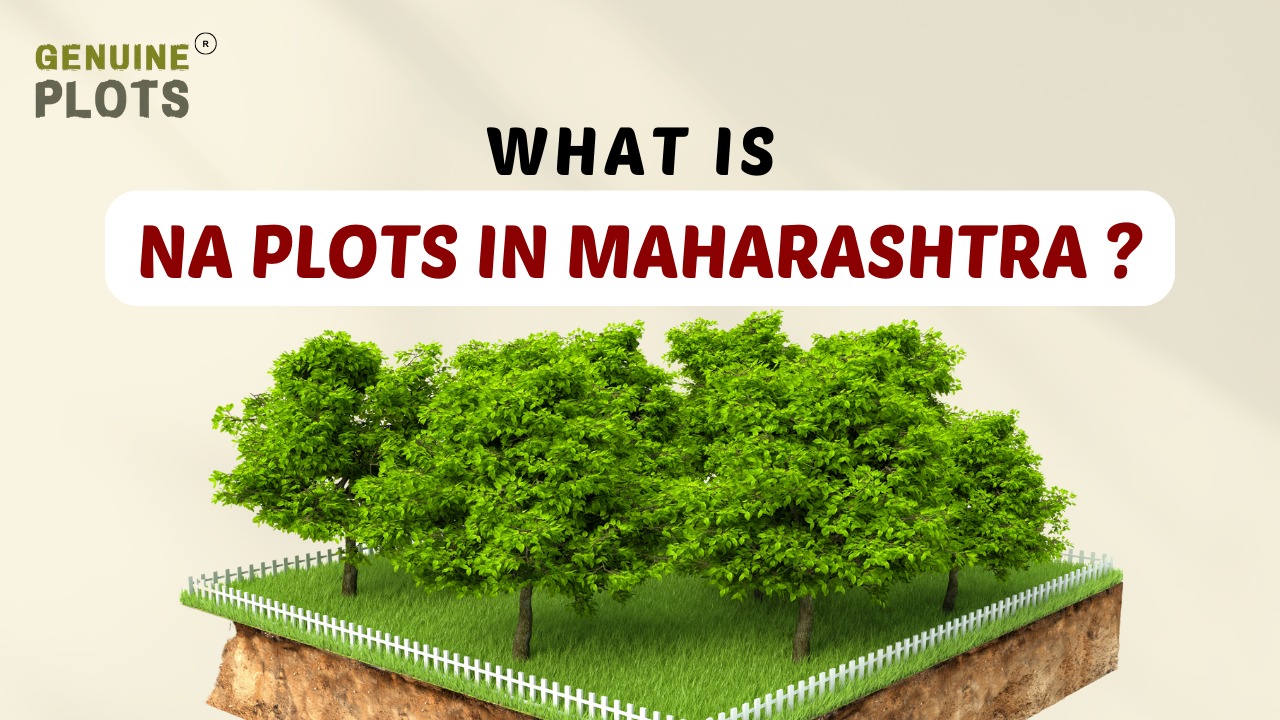
An NA plot, a non-agricultural plot, is considered unsuitable for agricultural activities. Instead, it offers various possibilities for development, including the construction of residential homes, apartments, shopping malls, office buildings, and factories.
What are the different types of NA Plots?
Non-agricultural plots encompass various land types, each serving distinct purposes. These include residential plots catering to housing needs; commercial plots, facilitating the establishment of businesses; warehouse plots, providing storage and logistics solutions; and IT land, dedicated to developing technology and related infrastructure. Each plot type offers its own defining features and advantages to suit various developmental requirements.
Is NA order required in Maharashtra?
In a recent development, the Maharashtra government has taken a significant step by announcing that builders will no longer be required to obtain separate Non-Agricultural (NA) permission for plots.
This decision has been warmly received by realtors in the city. Prior to this, developers had to go through a cumbersome process of visiting multiple offices to secure NA permission, which often resulted in long waiting periods.
With the new ruling, this time-consuming and bureaucratic procedure will be eliminated, streamlining the development process and potentially accelerating construction projects across the state.
How can you obtain NA land in Maharashtra?
To obtain an NA certificate for land in Maharashtra, you'll need to follow these steps:
- Download the PDF application form for Non-Agricultural Permission.
- Complete the application form in duplicate and affix a court fee stamp of rupees 5.
- Provide the original Extract of 7/12 (land ownership document) and four photocopies.
- Include copies of relevant mutation entries pertaining to the land in question.
By submitting these required documents, you can obtain the Non-Agricultural permission certificate for your land in Maharashtra.
How to convert agricultural land into NA land?
Converting agricultural land to Non-Agricultural (NA) land in Maharashtra involves the following steps:
- Visit the District Collector’s Office and apply for land conversion.
- The District Collector will thoroughly verify the land and the proposed conversion.
- The Tahsildar, a revenue officer, will also verify the details and assess the suitability for conversion.
- Once the verification process is completed successfully, the Conversion Order will be issued, granting NA status to the land.
- Appropriate entries reflecting the land's new NA status will be made in the Revenue Records, officially recognizing the conversion.
Following these steps, you can convert agricultural land to NA land in Maharashtra.

Gunthewari land refers to a development where multiple plots are created through the unauthorized sub-division of privately-owned land under the Urban Land Act of 1976 provisions.
This type of land falls under the jurisdiction of the Maharashtra state government. In Gunthewari land, the original landowner or developers divide the property without obtaining the necessary approvals, forming numerous smaller plots without adhering to proper legal procedures.
These areas often lack essential infrastructure and may face regulatory challenges due to their unauthorized status.
What types of land are there in Gunthewari?
Within Gunthewari, you will come across four primary types of land classifications. These include forest, agricultural, desert, and urban land.
Each category possesses distinct characteristics and serves specific purposes, offering diverse options for potential development or investment.
Understanding these different land types is crucial when considering any projects or investments in Gunthewari.
Is Gunthewari land a safe investment?
Gunthewari land can be a viable option if you are considering long-term investment opportunities. However, it's crucial to be cautious about the location selection, as these lands may be in flood-prone areas. Therefore, investing in a plot that is not at risk of flooding is essential.
On the positive side, Gunthewari land can be a safe and secure investment, especially in areas with low crime rates. Choosing a plot in a safe and secure neighborhood is important to ensure the best outcome, offering a promising prospect for your investment endeavors.
How can you get a Gunthewadi land lease?
To secure a Gunthewari land lease, begin by identifying a suitable plot of Gunthewari land you wish to lease. Subsequently, contact the landowner and express your intention to lease the land.Upon expressing interest, the landowner will furnish you with a lease agreement that outlines the terms and conditions.
After carefully reviewing the agreement, sign it and return it to the landowner. As per the agreement, you must make monthly payments as per the agreed-upon lease amount. By following this process, you can successfully obtain a Gunthewari land lease for your intended use or investment.- Genuine Plots

A title clearance certificate is a document issued by solicitors and advocates that confirms the legitimacy of ownership and verifies the absence of disputes, liens, debts, or encumbrances associated with a specific property.
It provides crucial information such as the nature of the title held by the property promoter and vendor, any claims or encumbrances related to the property, and the necessary steps to clear the title and make it legally marketable. Additionally, it clarifies whether the sale agreement will legally bind the property owner and helps address any doubts regarding the nature of the vendor or promoter.
How to Acquire a Title Search Report?
To acquire a title search report, you need to engage the services of an advocate or solicitor. They will conduct a thorough investigation by examining registered documents at the local sub-registrar’s office (SRO).
The process of obtaining a comprehensive title search report involves scrutinizing various aspects such as the property's ownership history, building permits, zoning regulations, and property rights.
To ensure a clear and accurate report, a buyer typically hires an advocate who specializes in assessing the legal documents associated with the property. The advocate's task is to identify any encumbrances, disputes, or other issues affecting the property's title and compile a detailed report accordingly.
To determine if a property has a clear title, consider the following steps:
- Thoroughly examine the title papers: Review the property's title documents in detail. It is advisable to engage a lawyer with expertise in property law to assist you in this process. A clear title indicates the absence of any disputes or legal issues associated with the property.
- Verify bank approvals: If the property has received approval from reputable banks or financial institutions, it generally indicates that it is free from encumbrances and disputes. Banks typically conduct their own due diligence before approving a property for financing.
- Obtain an encumbrance certificate: Request an encumbrance certificate from the local sub-registrar office (SRO) to verify the title clearance. This document will disclose any mortgages, liens, or other encumbrances on the property.
- Cross-check approved plans: Ensure the site aligns with the approved building plans. This step helps confirm that the property complies with local regulations and that there are no unauthorized constructions or deviations.
- Review property tax slips: Inspect the property tax payment receipts when considering a resale property. Clear and up-to-date property tax records indicate a clear title and ownership.
- Confirm necessary documents: Ensure the seller provides all necessary documents proving title clearance. This may include previous sale agreements, possession certificates, and other relevant paperwork.
When seeking professional advice from Genuine Plots and following these steps, you can thoroughly check to determine if a property has a clear title.
Understanding Land Records in India: Your Guide to Khatian Numbers

Every piece of land in India has important documents that tell us who owns it, what it's used for, and other essential details. Just like we have papers to show who we are and our rights, land has a Record of Rights (RoR) or Khatian.
A Khatian number is like an ID for the land. It holds all the information about a piece of land, like who owns it and its history. When the government gives land records to owners, each record is assigned a Khatian number. This number includes DAG/khasra, khata, and Khatauni numbers.
Land records are vital because they prove who owns the land and other certified details. They help gather all the necessary information about the land, prevent fraud, and avoid illegal activities or land grabbing. These records are also crucial in legal matters related to properties.
Now, let's talk about some important terms:
DAG number: The Khasra number is like an ID for a piece of land in villages or plots in urban areas. It tells us about the ownership of the land, the type of soil, the crops that can be cultivated, and the history of the land.
Khata number: This is given to joint landowners, providing information about co-owners and their holdings in the land. Suppose there are changes in the land's ownership; a new khata number is given.
Khatauni number: Unlike Khasra and Khata numbers, Khatauni is assigned to cultivators, not the land. It contains information about the cultivators and their cultivation areas.
Khasra, Khata, and Khatauni numbers give us details about the land, its ownership, and the people cultivating it. You can easily find this information online or by visiting the official land records office.
Understanding these numbers is essential, especially for those who own or are interested in land. They help in knowing the history of the land and any changes that might have happened over the years. These numbers are like a land's identity card for non-English speakers, telling its story and ensuring its rightful ownership.
In Maharashtra, you can find your Khasra, Khata, or Khatauni details by visiting the following website Bhulekh Mahabhumi.Let Genuine Plots be your guide through seamless plot buying paperwork. Discover your dream plot effortlessly.
Gram Panchayat Plots: Buying Tips and Risks for Informed Investments
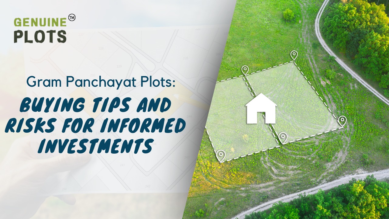
Investing in Gram Panchayat lands has become popular, offering an attractive option for those seeking affordable property. These plots, falling under the jurisdiction of Gram Panchayats, often boast lower prices compared to city properties, making them a compelling choice for investors.
Understanding Gram Panchayat Lands:
Gram Panchayat lands are primarily agricultural and are intended for farming activities. However, their appeal lies in the potential for conversion into non-agricultural land, allowing for residential or commercial use. To convert, one must obtain consent for a "change of land use" from local authorities, typically the collector or district magistrate.
Conversion Process:
The conversion process involves submitting an application detailing the property's specifics, reasons for conversion, and relevant documents such as ID proof, certified survey maps, and mutation letters. The Land Revenue Department's commissioner reviews the application, ensuring no pending dues or litigation on the land.
Merits of Buying Gram Panchayat Plots:
- Lower Investment Cost: Gram Panchayat plots offer reasonable prices, making them suitable for those with smaller budgets.
- Higher Returns: These plots have high resale value, offering the potential for greater profits in the long run.
Demerits of Buying Gram Panchayat Plots:
- Basic Amenities: Gram Panchayat areas may lack certain facilities like electricity, water supply, and proper sewage, requiring adjustments to a simpler lifestyle.
- Connectivity Issues: The infrastructure in Gram Panchayat areas may not match city standards, with challenges in road conditions and limited transportation options.
Wrapping Up
While Gram Panchayat plots present affordable investment opportunities with potential returns, weighing the benefits against the challenges is essential. Understanding the conversion process and being prepared for adjustments in lifestyle and infrastructure can lead to a successful and fulfilling investment. Always conduct thorough research and seek guidance of Genuine Plots to make informed decisions in the dynamic world of real estate.
Recent Posts
Tags
Bhunaksha,
genuine plots,
Land For Sale,
Maharashtra Bhunaksha,
plots for sale,
Gunthewari,
Gunthewari Land,
Gunthewari Rules,
Extract Documents,
Plots and Lands,
Saat Baara,
Extract Saat,
Baara Utara,
Jamabandi,
property tax payments,
Gram Panchayat,
lower prices,
non-agricultural land,
Lower Investment Cost,
Gram Panchayat lands,
Fresh Land Settlements,
Growing demand,
affordable homes,
genuine p,
legal Land,
bungalow plots,
Konkan,
Maharashtra,
Purandar,
Pune,
Karnataka,
Bangalore,
Farm Land,
Kolkata,
Rajarhat,
Indore,
Chhatrapati Sambhajinagar,
Aurangabad,
Mundhwa,
Agricultural Land,
Farmhouse Plot,
Rules And Penalties,
Residential Plots,
NA PLots,
Residential NA Plots,
Commercial NA Plots,
Animal Husbandry Land,
Tathawade,
Vahivat Land Maps,
Vahivat,
Indian Land Records,
Ownership Rights,
Red zone,
PCMC,
Dehu Road,
Land Registration Rules,
Land Investing,
Infrastructure Growth,
Land Ownership,
Land Encroachment,
Panshet Dam,
Varasgaon Dam,
Verified Land,
Plot For Sale,
Land Investment,
Verified Plots,
Land Acquisiton,
Hydrological Survey,
Invest In Land,
Verified Land Plots,
Panshet,
Khadakwasla,
Land Rules,
Dakhil Kharij,
Land Registry,
Property Onwership,
Clean Title Check List,
Property Verification,
Digital Registry,
Farm Plots,
Agro Property,
Land Value Growth,
Urban Expansion,
Senapati Bapat Road,
Registered Land,
Agricultral Plot,
Purandar Airport,
Safe Investment,
Secure Property,
Plot Buyers,
Approved Plots,
Land ROI,
NA Approved Plots,
NA Land,
Welspun One,
Logistic Park,
Talegaon,
PMC Bharat Mandapam,
Urban Development,
Lohgaon,
Close To Nature,
Gated Community Plots,
Buy Land VS Gold Investment,
NRI Investment,
Future Ready Living,
Trusted Plots,
Plot Investment,
Authentic Land,
Safe Land Buying,
Mumbai,
Premium Plots,
MMR Land Investment,
MMR Infrastructure,
Metro Connectivity,
Plots in Mahabaleshwar hill station investment,
Mahabaleshwar land prices and future growth,
Scenic residential plots in Mahabaleshwar,
Mumbai 3.0,
Mumbai 3.0 vs Mumbai 2.0,
Mumbai property investment,
Real estate investment in Mumbai,
Upcoming residential projects in Mumbai,
CIDCO plot auctions,
CIDCO auction Navi Mumbai,
Upcoming CIDCO plot auctions 2026,
CIDCO land auction dates,
Navi Mumbai plot auctions,
CIDCO plots in Navi Mumbai,
CIDCO plots in Kharghar,
CIDCO plots in Ulwe,
NMIA investment opportunities,
Mumbai 3.0 plotted development,
Mumbai 3.0 real estate,
Plots in Mumbai 3.0,
Land investment in Maharashtra,
Residential plots near Mumbai,
Land appreciation in Mumbai 3.0,
Residential land for sale in Mumbai 3.0,
Altamura NA Plots,
Altamura Nadar City,
NA Plots in Nadar City,
Nadar City Plots,
Plots in Nadar City,
YEIDA plots,
YEIDA plots near Noida Airport,
Noida Airport plots,
Jewar Airport investment,
Yamuna Expressway plots,
YEIDA plot scheme 2026,
Noida Airport real estate,
Zepto,
Zepto effect,
D2C brands India,
Urban consumer trends,
Marketplace evolution,
Urban infrastructure growth,
YEIDA Residential Plot Scheme,
Yamuna Expressway Plot Scheme,
YEIDA Residential Plots,
Yamuna Expressway Authority,
Noida Investment,
Residential Plots in Lucknow,
LDA Plots in Lucknow,
Lucknow Real Estate,
LDA Approved Plots,
Plots for Sale in Lucknow,
Lucknow Property Investment,
Land Investment in Lucknow,
Residential Land in Lucknow,
Buy Plot in Lucknow,
Lucknow Development Authority,
Maharashtra Fragmentation Law 2025,
Fragmentation Act Maharashtra,
Maharashtra land law update 2025,
Maharashtra land reforms 2025,
Land subdivision rules Maharashtra,
Maharashtra agriculture land purchase rules,
Agricultural land purchase restrictions Maharashtra,
Can non-farmers buy agricultural land in Maharashtra,
NA conversion process Maharashtra,
Collector permission for land purchase,
farmland prices in Nagpur,
agricultural land price in Nagpur per acre,
farmland cost in Nagpur Maharashtra,
Nagpur agricultural land investment,
per acre agricultural land rate in Nagpur,
Tukdebandi Law Maharashtra,
Maharashtra Fragmentation Act update,
Land subdivision law Maharashtra,
Agricultural land division Maharashtra,
Maharashtra land reform ordinance,
Plot registration Maharashtra,
Farmland prices Nagpur,
Nagpur agricultural land rates,
Farmland per acre Maharashtra,
Agricultural land price Nagpur,
Farm land cost Nagpur,
Nagpur real estate trends,
Land investment Nagpur,
Avani Farms,
Avani Farms Pune,
Farmland near Pune,
Farm plots for sale,
Agricultural land investment,
Gated farmland near Pune,
NRI agricultural land rules India,
Can NRI buy agricultural land in India,
FEMA rules for NRI property purchase,
RBI guidelines for NRI land investment,
NRI farmland investment India,
Agricultural land purchase by NRI,
Maharashtra Fragmentation Act,
Minimum plot size in Maharashtra,
Guntha rules Maharashtra,
Agricultural land division rules,
Minimum land area for sale in Maharashtra,
Legal plot size in guntha,
Guntha conversion rules,
NRI land purchase in India,
Can NRIs buy agricultural land in India,
NRI property investment India,
NRI buying residential land,
NRI real estate guidelines India,
Investment tips for NRIs in India,
Mutation Entry Process,
Land Mutation in India,
Property Mutation Process,
Land Ownership Transfer,
1 guntha na plot prices in pune 2026,
1 guntha plot price in pune,
na plots in pune,
residential na plots pune,
guntha plot rate in pune,
na plot investment in pune,
plots near purandar airport,
1 Acre Land Price in Pune,
Pune Land Rates 2025,
Pune Land Price 2026,
Pune Acre Land Cost,
Land Value Pune,
Agricultural Land Price Pune,
gated community plots in Hinjewadi,
Hinjewadi plots for sale,
residential plots in Hinjewadi Pune,
premium plots in Hinjewadi,
plots near Rajiv Gandhi Infotech Park,
land for sale in Hinjewadi Pune,
Pune property investment,
plots for sale in Pune below 5 lakhs,
Pune rural land investment,
gated plotting projects Pune,
MIDC growth corridor plots,
Residential plots for sale in Hinjewadi,
Plots in Hinjewadi Pune,
Land for sale in Hinjewadi,
Residential NA plots Hinjewadi,
Hinjewadi real estate trends 2026,
Nashik land investment,
Trimbakeshwar land for sale,
Simhastha Kumbh 2026,
Simhastha Kumbh 2027 real estate impact,
Trimbakeshwar property investment,
Land appreciation in Nashik,
plots for sale in pune,
types of plots in pune,
residential plots in pune,
agricultural land in pune,
villa plots in pune,
NRI agricultural land purchase India,
NRI property investment in India,
Agricultural land rules for NRIs,
NRI real estate investment India,
NA plot meaning,
what is NA land,
NA land in Maharashtra,
land investment guide,
NRI agricultural land in Telangana,
Telangana land laws for NRI,
Telangana real estate laws,
NRI investment guide Telangana,
Legal compliance for NRI property,
NRI farmhouse purchase India,
RBI guidelines for NRI property,
NRI land buying rules,
Godham Eco Village,
Godham Eco Village for NRIs,
NRI land investment in India,
Investment plots for NRIs,
Secure land investment India,
NRI property buying guide,
plots in Pune,
NRI buying property in India,
NRI guide to buying land in Pune,
NRI land investment in Pune,
NRI property documents checklist,
Maharashtra land reform 2025,
Maharashtra land laws update,
Agricultural land rules in Maharashtra,
Buying agricultural land in Maharashtra,
Non-agricultural land conversion Maharashtra,
Maharashtra agricultural land rules 2024,
agricultural land purchase in Maharashtra,
non agriculturist land purchase rules,
who can buy agricultural land in Maharashtra,
Maharashtra land laws for non farmers,
Guntha based land rules,
Minimum guntha rule Maharashtra,
Maharashtra land laws,
Maharashtra agricultural land laws,
farmland investment Maharashtra,
buying farmland legally in Maharashtra,
NA conversion rules Maharashtra,
agricultural land eligibility criteria,
Property Mutation in India,
Land Record Update,
Revenue Records,
Property Ownership Transfer,
Mutation of Property,
Farmhouse Plots Near Pune,
NRI Investment in Pune,
Pune Real Estate,
Plots for Sale Near Pune,
Luxury Farmhouse Plots,
Pune plot scams,
Plot buying checklist,
Legal verification for plots,
NA plot verification,
Plot buying tips Pune,
Godrej Properties,
Evora Estate Panipat,
Luxury plots in Panipat,
Premium land investment,
Residential plots in Panipat,
Lodha Developers,
Lodha Developers Q3 acquisition,
Lodha land parcels Q3,
Indian real estate news,
New residential projects India,
Real estate investment news,
Premium housing projects,
Srijan Group,
Kolkata Tech Park,
Commercial Real Estate,
Real Estate Investment,
Real Estate Deal News,
NRI investment in India,
NRI land investment,
Plots for sale in India,
NRI property investment,
Can NRI buy residential plot in India,
NRI land purchase rules,
Residential plots for NRIs,
NRI real estate investment,
NRIs buying property in India,
Can NRIs buy plots in India 2026,
RBI rules for NRI property purchase,
NRI land investment rules,
MMR 3.0,
MMR real estate 2026,
Mumbai real estate market,
Navi Mumbai investment,
Thane property market,
Mumbai property trends 2026,
Land investment in MMR,
Mumbai smart city project,
Korea Mumbai partnership,
MMRDA infrastructure projects,
Korean investment in India,
MMR GDP growth,
MMR economic roadmap 2030,
Mumbai real estate,
Public private partnership projects Mumbai,
Investment opportunities in MMR,
Mumbai Metropolitan Region,
Mumbai urban development,
MMR 2047 vision,
Mumbai infrastructure projects,
Navi Mumbai development,
Goa property investment,
Invest in Goa 2026,
Goa real estate market 2026,
Best places to invest in Goa,
North Goa property,
Property appreciation in Goa,
Goa plots for sale,
Commercial property in Goa,
Buy property in Goa,
YEIDA plots 2026,
Residential plots in YEIDA,
YEIDA new scheme update,
Plots near Noida International Airport,
Yamuna Expressway Authority plots,
YEIDA housing scheme details,
Lucknow land investment,
Property in Lucknow,
Buy plots in Lucknow,
Nashik plots for sale,
Kumbh Mela 2026 Nashik,
Land investment in Nashik,
Nashik property market 2026,
Plots near Kumbh Mela Nashik,
Residential plots in Nashik,
Upcoming projects in Nashik,
Property appreciation in Nashik,
Maharashtra land investment,
Nashik Kumbh Mela 2026,
Kumbh Mela investment opportunities,
Infrastructure development in Nashik,
Plots near Nashik Kumbh Mela,
High ROI land investment,
MIHAN,
MIHAN Nagpur,
Nagpur Real Estate,
Agricultural Land Nagpur,
Nagpur Property,
Plots Near In MIHAN,
Pune residential plots,
best areas to buy plots in Pune,
Pune land investment,
investment plots in Pune,
buy land in Pune,
real estate investment in Pune,
Godrej Plots Doddaballapur,
Doddaballapur plots for sale,
Plots in North Bangalore,
Godrej Properties plots,
Residential plots in Doddaballapur,
Investment plots near Bangalore,
Gated community plots Bangalore,
Premium plots in Doddaballapur,
plots in Mahabaleshwar,
Mahabaleshwar villa plots,
farmhouse plots in Mahabaleshwar,
land for sale in Mahabaleshwar,
bungalow plots in Mahabaleshwar,
hill station property investment,
agricultural land in Mahabaleshwar,
premium land in Mahabaleshwar,
Plots in Pune under 3 lakhs for sale,
Budget residential plots near Pune,
Low cost plots near Pune highway connectivity,
plots in Pune under 3 lakhs,
farmland plots near Pune city,
Investment plots near Pune under budget,
Residential land near Pune,
Godrej plots in Pune,
Premium plotted development by Godrej in Pune,
Residential land for sale by Godrej,
Premium plot by Godrej,
Plots for sale in Hadapsar Pune,
Residential plots in Hadapsar,
Investment plots in Hadapsar,
Gated community plots in Hadapsar,
Ready to build plots in Hadapsar,
1 Guntha plot in Pune,
1 Guntha plot in Pune for sale,
1 Guntha plots near Pune city,
Residential 1 Guntha land in Pune,
Clear title 1 Guntha plot in Pune,
1 guntha plot price in village,
village plot rate per guntha,
affordable 1 guntha land in rural area,
residential plot in village Pune,
farmland plot price per guntha,
Residential 1 Guntha plot near Pune city,
Investment plots in Pune 1 Guntha,
Clear title 1 Guntha land in Pune,
Agricultural 1 Guntha plot near Pune,
1 Guntha plot in Pune Katraj for sale,
Residential plot in Katraj Pune 1 Guntha,
Katraj Pune land for home construction,
1 Guntha NA plot in Katraj Pune,
Pune Katraj plot near highway connectivity,
Gated plot project in Katraj Pune,
NA plots in Pune under 10 lakhs,
Affordable NA plots near Pune city,
NA residential plots in Pune,
NA approved plots in Pune under 10 lakhs,
Investment plots in Pune under 10 lakhs,
Residential NA plots near Pune highway,
Best plots in Pune below 10 lakhs,
Premium villa plots in Pune,
Residential villa plots in Pune near city outskirts,
Luxury villa plots in Pune,
Gated villa plot project in Pune,
Villa plot site visit in Pune,
NA plots in Pimpri Chinchwad for sale,
Residential NA plots in PCMC area,
NA approved plots in Pimpri Chinchwad,
NA land with clear title in PCMC,
NA plots near Pune Mumbai Highway PCMC,
Godrej Villa Plots Doddaballapur,
Godrej plotted development Bangalore,
villa plots in North Bangalore,
premium villa plots Bangalore,
Godrej Properties plots Bangalore,
Brigade Plots Malur,
Brigade Malur plots,
plots in Malur East Bangalore,
investment plots in East Bangalore,
residential plots in Malur Bangalore,
Brigade Group plots Bangalore,
land investment in East Bangalore,
gated community plots in Malur,
prestige plots devanahalli,
prestige plots in devanahalli bangalore,
plots for sale in devanahalli,
prestige plots investment,
premium plots in devanahalli,
residential plots near kempegowda airport,
What is NA plot in real estate,
NA land meaning in property,
NA approved plotsDifference between NA and agricultural land,
Buying NA plots in Maharashtra,
NA plot vs agricultural land,
Plot prices in Mysore,
Mysore infrastructure projects,
Mysore property investment,
Land investment in Mysore,
Plot investment opportunities,
land buying guide in goa,
buy land in goa,
plots for sale in goa,
legal process to buy land in goa,
property in goa,
residential plots in goa,
Nashik Simhastha Kumbh Mela 2026,
Sadhugram expansion Nashik,
Maharashtra Kumbh Mela planning,
Nashik Kumbh Mela preparations,
tourism development in Nashik,
plots in Nagpur,
Nagpur plot investment,
land for sale in Nagpur,
residential plots in Nagpur,
golden rules before buying plots in Nagpur,
Nagpur land investment,
plot investment in Nagpur,
land investment in Nagpur,
plots for sale in Nagpur,
best areas to buy plots in Nagpur,
buying plots in Nagpur,
plot purchase checklist,
legal checklist for buying land,
documents required for plot purchase,
NA plots in Nagpur,
Tattvana,
Tattvana in Kamshet,
Moregaon Farmland Estates,
farmland investment Pune,
agricultural land investment,,
farmland for sale near Pune,
farm plots in Pune,
gated farmland projects,
agricultural plots Maharashtra,
open plot vs NA plot,
difference between open plot and NA plot,
what is NA plot in India,
open plot meaning in real estate,
NA land vs agricultural land,
residential NA plots benefits,
land investment in India,
buying NA plot vs open land,
capital gains on agricultural land,
rural vs urban agricultural land tax,
agricultural land tax rules India,
capital gains tax India property,
is agricultural land taxable,
rural agricultural land exemption,
urban agricultural land tax India,
Runwal Enterprises Alibaug township,
Alibaug real estate,
coastal real estate India,
township projects in Alibaug,
luxury properties in Alibaug,
Mumbai weekend homes investment,
Alibaug property investment,
isprava south goa,
ultra luxury villas in goa,
south goa real estate,
luxury homes in goa,
isprava projects goa,
premium villas in south goa,
land investment advisory services,
secure land investment,
real estate advisory services,
verified land deals,
investment plots near Pune,
land buying guide India,,
#KanpurRealEstate,
#KDAPlots,
#KanpurProperty,
#RealEstateKanpur,
#PropertyTrends,
Gokul Plots investment,,
real estate investment Gokul,,
plots with high appreciation potential,
smart land investment strategies,
plots for sale in North Bangalore,
land investment Bangalore,,
emerging areas in North Bangalore,
residential plots Bangalore,,
Bangalore real estate investment,,
North Bangalore property trends,,
plots near airport Bangalore,,
HUDA plots in Gurgaon,
HUDA plots in Faridabad,
residential plots Haryana,
HUDA approved plots,
plots for sale in Gurgaon,
plots in Faridabad investment,
Prestige Marigold plots,,
Bangalore plotted developments,
land investment Bangalore,
best plots in North Bangalore,
#PlotsForSaleInNellore,
#NelloreRealEstate,
#NellorePlots,
#RealEstate2026,
#PropertyInvestment,
#NelloreProperty,
#AndhraPradeshRealEstate,
GMADA E Auction 2026,
GMADA plots Mohali,
plots in Mohali for sale,
GMADA Mohali auction process,
buy plots in Mohali,
Punjab property investment,
GMADA scheme 2026,
Mohali real estate,
HSVP plots 2026,
HSVP plot investment,
HSVP plots Haryana,
land investment benefits,
residential plots investment,
government approved plots,
buy plot in New Chandigarh,
flats in New Chandigarh,
New Chandigarh real estate,
property investment in New Chandigarh,
residential plots in New Chandigarh,
apartments in New Chandigarh,
#WaveCityGhaziabad,
#GhaziabadPlots,
#PlotsInGhaziabad,
#NCRRealEstate,
#RealEstateInvestment,
#ResidentialPlots,
APIIC vacant plots,
APIIC plots for sale,
industrial plots in Andhra Pradesh,
commercial land for MSMEs,
startup investment plots,
APIIC industrial land,
HUDA plots,
HUDA plots investment,
property appreciation,
plot investment benefits,
high return property investment,
land appreciation,
#GDAPlotsInGhaziabad,
#PlotsForSaleInGhaziabad,
#ResidentialPlotsGhaziabad,
#InvestmentPlots,
#RealEstateGhaziabad,
#GDAApprovedPlots,
#BaliProperty,
#PropertyInBali,
#IndiansInBali,
#BaliRealEstate,
#InternationalPropertyInvestment,
buy plots in Sarjapur Road Bangalore,
plots in Sarjapur Road,
residential plots in Sarjapur Road,
land for sale in Sarjapur Road Bangalore,
investment plots in Bangalore,
plots near IT corridor Bangalore,
how Indians can buy property in Bali,
buy property in Bali for Indians,
Bali property investment,
property in Bali for Indian buyers,
Bali real estate guide,
foreign property investment Bali,
legal checks before buying property in Bali,
Indians invest in Bali property,
due diligence for Bali property,
Bali real estate for Indians,
Bali property legal verification,
verified farmland plots,
100% verified farmland plots,
farmland investment India,
legal farmland plots,
farmland plots for sale,
Konkan land investment,,
high-growth corridors Maharashtra,
land investment 2026,
plots for sale in Maharashtra,