Prev Post
How to Choose the Right Agricultural Land for Farming — A Deep Guide
Land is one of the few assets that appreciates consistently when supported by the right set of external factors. Its value seems static but through time, it gets shaped by infrastructure, location, policy changes, and socio-economic demand. Here are the seven major factors that influence long-term appreciation.
1. Location & Connectivity
The most important factor influencing land value is still location. Plots near developing cities, planned highways, transportation hubs, or industrial corridors appreciate considerably more quickly. Increased demand and consequently higher prices are the results of improved connectivity, such as new expressways, metro links, widened roads, or airport improvements.
Improved logistics, shorter travel times, and increased residential and commercial interest are all benefits of improved access. This frequently results in a discernible rise in real estate prices even before infrastructure projects are finished.
2. Infrastructure & Basic Utilities
Availability of water supply, electricity, road access, drainage, and telecom connectivity adds immediate usability and desirability to land. Even raw plots with easy access to utilities enjoy a higher valuation.
The areas in which local authorities invest, such as streetlights, sewage systems, waste management, or road widening, become naturally more attractive for both developers and end-users. Infrastructure development often initiates multi-year appreciation cycles in surrounding land.
3. Zoning Ordinance & Land-Use Approval
Government zoning policies directly impact the value of land. Land zoned residential, commercial, or industrial sells at a higher price than strictly agricultural areas because of the higher development potential.
Prices for land that can be lawfully rezoned or converted—for instance, from agricultural to residential or commercial—usually rise quickly. In a similar vein, clear title deeds, uncontested ownership, and the absence of litigation boost marketability and buyer confidence, which drives up prices.
4. Supply-Demand Disequilibrium
Land is intrinsically scarce. As populations grow, cities expand, and industries migrate to newer areas, the demand for usable land goes up, but its supply remains fixed.
High-growth areas, especially tier-I and tier-II cities, tend to enjoy sustained demand from both buyers and developers. When demand surpasses supply, appreciation becomes inevitable. This holds true to a large extent in suburban corridors where urban sprawl transforms the countryside into residential and commercial hotspots.
5. Future Development Potential
Land appreciation is highly dependent upon the expectations of future development. Announcements related to:
- new highways
- metro or rail corridors
- industrial parks
- IT hubs
- logistics zones
- residential townships
…tend to drive early investor interest and cause value increases even before construction starts.
Speculation is seldom all wrong-it simply mirrors genuine future potential. As a rule, the investors who identify early signs of urban growth usually benefit the most.
6. Natural Features & Environmental Conditions
Topography, soil quality, access to water, and lack of environmental hazards are highly influential in determining value, particularly for agricultural, resort, or residential land.
The lands that have beautiful scenery, a body of water around it, or even slight slopes command better prices. In contrast, land requiring heavy levelling, environmental clearance, or flood mitigation appreciates more slowly because of the high cost of development involved.
7. Social Amenities & Neighbourhood Growth
Land demand is boosted by the presence of schools, hospitals, markets, shopping centres, parks, and public services in the area. When an area becomes socially well-developed, it attracts families, businesses, and builders, thereby establishing a long-term upward trend of land price improvements.
Even agricultural land near expanding residential belts can appreciate dramatically once neighbouring regions begin to urbanise.
Conclusion
Accessibility, infrastructure, legal clarity, development potential, environmental quality, and social growth all contribute to an increase in land value. Even though land is a reliable long-term investment, investors can find plots with the highest potential for appreciation by understanding these seven factors. Land can provide substantial returns for decades if strategic research and due diligence are done.
Bhor: Where Nature, Connectivity, and Business Converge for Investment

Bhor, a charming tourist town in the Pune district, is located approximately 50 kilometers south of Pune. It enjoys excellent road connectivity with Pune through SH 70, as well as easy access to the Bangalore Pune Highway (NH-48). Bhor is conveniently situated just 15-20 kilometers away from the Kesurdi MIDC and the industrial area in Shirwal. This strategic location makes Bhor an attractive destination for both tourists and business activities. One can explore the nature's beauty of the region while also taking advantage of its proximity to industrial areas and major transportation routes. Bhor truly offers the best of both worlds.
Why invest in plot properties in the Bhor region
Investing in plot properties in the Bhor region offers several compelling reasons. Firstly, the area boasts breathtaking scenic beauty, with its lush green landscapes, rolling hills, and tranquil surroundings. This natural beauty enhances the quality of life and makes it an attractive destination for those seeking a peaceful lifestyle.
Secondly, Bhor is strategically located near employment hubs and industrial areas such as Kesurdi MIDC and Shirwal. This proximity to thriving economic zones ensures a steady demand for residential and commercial properties, making it an ideal choice for investment.
Additionally, the region has witnessed a significant appreciation in land properties over the years. As the value of plots in Bhor is expected to increase, providing investors with a promising opportunity for capital appreciation.
What type of land properties are available in Bhor?
Residential Plot
Hill view Plots
Lakeview Plots
Advantages of owning a plot property in Bhor
One of the key advantages of this investment opportunity is the low initial investment required. With a low entry point, individuals can easily enter the market and benefit from the potential returns. Additionally, another benefit is the low property tax associated with this investment. This not only helps to minimize the ongoing costs but also increases the overall profitability of the investment. Furthermore, the land in question appreciates rapidly, indicating its potential for long-term growth and capital appreciation. Lastly, this investment offers greater flexibility, allowing investors to adapt and adjust based on market conditions and their financial goals.
Economy / Infrastructure in Bhor
Industries in SKD Shiv Industrial Park, Shirwal, are approximately 16 km away from Bhor, offering convenient accessibility.
Bhor boasts prominent educational institutions such as Anantrao Thopte College, Gurukul English Medium School, and Jijamata Vidyalaya.
The locality has healthcare facilities, including Burande Hospital, Patil Hospital, and Nachiket Hospital.
Residents can enjoy recreational facilities within a 5 km radius such as the Cricket Ground in Ganesh Nagar Bholawade, Bholawade Udyan, Nani Nana Park, and Municipal Garden.
Bhor offers proximity to popular tourist attractions like Bhor Rajwada, Basarapur Lake, and Bhatghar Dam Floodgates Viewpoint, all within a 6 km radius.
Connectivity of Bhor
Bhor is conveniently connected to Pimpri and neighboring areas through the SH70 and NH 48 routes, ensuring easy accessibility. The smooth bus connectivity to Pune, Satara, and Mumbai further enhances the convenience for residents and travelers alike. Moreover, Valha Railway Station is a vital link, connecting Bhor to major neighborhoods and localities, facilitating efficient transportation options.
About Genuine Plots
Don't let paperwork complications hinder your land purchase. Opt for Genuine plots and experience a seamless transaction. Say goodbye to legal disputes and hello to peace of mind. Take action now and secure your dream property with confidence. Call us and simplify your land-buying journey.
West Pune: Where Well-Developed Infrastructure Meets Investment Opportunities
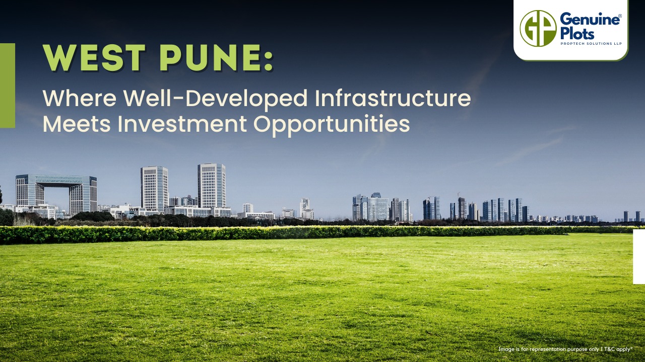
West Pune provides residents with modern housing options and the convenience of business centres, shopping areas, and healthcare facilities. The region's better town planning and infrastructure contribute to an organised and well-developed environment. Additionally, there has been a focus on improving transport and public facilities, ensuring enhanced connectivity and amenities for the residents. With its comprehensive offerings and ongoing development, West Pune presents an attractive destination for individuals seeking a comfortable and convenient lifestyle.
Why invest in West Pune?
Thanks to the region's rapid development and increasing demand, it provides a better return on investment than other areas. Additionally, there is a reduced risk associated with investment in West Pune due to its established infrastructure and growing popularity among homebuyers. Moreover, investors have the flexibility of design, as they can choose from a variety of modern housing options and customise their investments according to their preferences. With these factors combined, investing in West Pune proves to be a lucrative opportunity for individuals looking for a profitable and secure investment venture.
What type of plot properties are available in West Pune?
Residential Plots
NA Plots
What are the advantages of owning a plot in West Pune?
Buying a plot in West Pune offers several advantages. Firstly, it provides the flexibility of ideas, allowing buyers to design and construct their dream homes according to their preferences. Additionally, purchasing a plot in this region is a low-cost investment option compared to buying a fully constructed property. This affordability, combined with the region's rapid development, ensures a good return on investment. Moreover, the paperwork involved in buying a plot in West Pune is relatively easy and hassle-free. Furthermore, the property tax rates in this area are comparatively lower, reducing the financial burden for the buyers. With attractive pricing and the potential for customization, buying a plot in West Pune presents an enticing opportunity for those seeking a cost-effective and personalised investment.
About Genuine Plots
When buying a land property, opting for Genuine plots can greatly help in the associated paperwork. Genuine plots typically have proper legal documentation, ensuring a transparent and hassle-free transaction process. Buyers can avoid legal disputes and complications with clear titles and accurate documentation. When purchasing a land property, choosing Genuine plots can provide peace of mind and convenience, facilitating a seamless experience through the paperwork requirements.

The Pawna region witnessed a significant transformation with the construction of the Pawna dam project in Maval taluka in 1973. The dam created a reservoir, resulting in Pawna Lake's formation from the backwaters. The proximity of this picturesque waterbody to the popular hill station of Lonavala and renowned forts such as Lohagad, Tikona, and Tung has contributed to a rapid rise in tourism in the region.
Pawna Lake's serene backwaters have become a sought-after destination for travellers seeking natural beauty and recreational activities. The tranquil atmosphere, surrounded by lush greenery and rolling hills of the Sahyadri mountain range, attracts visitors looking for a peaceful escape from the city's hustle and bustle.
Why Invest in plot properties in Pawna region?
1) Long-Term Legacy
2) Tax Advantages
3) Tangible Asset
4) Appreciation value
Connectivity of Pawna region
The Pawna region enjoys good connectivity with nearby cities, making it easily accessible for travellers. Here are the approximate distances from major cities to Pawna Lake:
- Pune to Pawna Lake:
- Via Kamshet: Approximately 65 km by car/bike.
- Via Paud: Approximately 52 km by car/bike.
- Via Somatne Phata: Approximately 57 km by car/bike.
- Mumbai to Pawna Lake:
- Via Kamshet: Approximately 117 km by car/bike.
Types of Plots available in Pawna region
1) Residential Land
2) Lakefront land
3) Hill view land
Infrastructure in Pawna Region
The Pawna region boasts a well-developed infrastructure. The area is characterised by the following features:
- Good Roads: The Pawna region benefits from well-maintained roads, ensuring smooth connectivity to and from the area. These well-paved roads make it easier for travellers to access the region, facilitating convenient transportation to various attractions and amenities.
- Good Medical Facilities & Emergency Services: The region has made significant strides in providing quality medical facilities and emergency services. Residents and tourists alike have access to healthcare centres, clinics, and hospitals offering various medical services. In the event of emergencies, prompt emergency services are available to ensure the well-being and safety of individuals.
- Restaurants & Eateries: Pawna region offers diverse restaurants and eateries.
About Genuine Plots
When considering the purchase of a land property, it is highly advisable to opt for Genuine plots, as they can greatly assist in the associated paperwork.
Buyers can avoid potential legal disputes and complications arising from unclear titles or inaccurate documentation by choosing Genuine plots. Genuine Plots provide buyers with peace of mind and convenience, as they can confidently navigate through the paperwork requirements, knowing that they are dealing with a property that has a solid legal foundation.
Ultimately, opting for Genuine plots simplifies the buying process and contributes to a smooth and satisfactory experience.
Khandala calling,investment opportunities for dream plots and properties

Khandala is a picturesque hill station located in the Western Ghats of Maharashtra, India. At an altitude of 550 metres, Khandala offers stunning panoramic views of the surrounding valleys, lush green hills, and waterfalls. Renowned for its natural beauty and pleasant climate, Khandala is a popular tourist destination, attracting visitors from near and far. It is located on the Mumbai-Pune Expressway, making it easily accessible from Mumbai (approximately 80 kilometres away) and Pune (approximately 70 kilometres away).
What Type of plot properties are available in Khandala?
1) Residential Plots
2) Agricultural lands
3) Commercial Land
What are the advantages of owning a plot in Khandala?
Khandala is a popular tourist spot and is close to Pune and Mumbai. The limited availability of land in such scenic areas can result in property appreciation over time, offering potential returns on your investment. Owning a plot in Khandala can be a sound long-term investment strategy.
Economy in Khandala
Khandala's economy primarily revolves around tourism and hospitality.The town attracts many visitors, especially during weekends and holidays, who enjoy the region's scenic beauty, pleasant climate, and recreational activities. Khandala benefits from its proximity to Pune and Mumbai, contributing to the economy through weekend tourism and second-home investments. Many people from these nearby cities visit Khandala for short trips or own properties for vacation purposes. Khandala also has a small agricultural sector, with some locals engaged in farming activities.
Why Live in Khandala?
Appreciation: Buying a plot property in Khandala, Pune, offers the potential for significant appreciation in value over time. Khandala is a highly sought-after location known for its scenic beauty, pleasant climate, and proximity to Pune and Mumbai. The growing demand for properties in Khandala and limited land availability can contribute to appreciating property prices, making it a lucrative investment option.
Tranquillity: Khandala is renowned for its tranquil and serene environment, away from the bustling city life. The region is surrounded by lush green hills, waterfalls, and picturesque landscapes, creating a peaceful and rejuvenating ambiance. Living in Khandala allows you to escape the noise and pollution of urban areas, providing a calm and relaxed lifestyle amidst nature's beauty.
Proximity: One of the significant advantages of owning a plot property in Khandala is its proximity to Pune.
Khandala is conveniently located approximately 70 kilometres away from Pune, making it easily accessible for commuting or weekend getaways. This closeness to Pune allows residents to enjoy a vibrant city's amenities, employment opportunities, and cultural attractions while residing in a tranquil hill station.
Investment: Buying a plot property in Khandala can be wise. As mentioned earlier, Khandala's popularity as a tourist destination and its proximity to Pune and Mumbai contribute to the increasing demand for properties in the area. Investing in a plot now can provide potential returns in the future, especially considering the limited availability of land in such scenic locations.
You can also build a custom-designed home or explore commercial opportunities based on local regulations and market dynamics.
Looking to buy Genuine plots in Khandala? Trust Genuine Plots for hassle-free documentation and seamless plot purchase. Contact us today!

Nestled amidst lush green valleys, a picturesque hill station near Mumbai captivates visitors with its enchanting beauty. Located just 65 km from Pune via road and 83 km from Mumbai via road, it is an ideal getaway for nature lovers and adventure enthusiasts. This hill station is considered one of the best tourist spots in Maharashtra. Its serene atmosphere, pleasant climate, and abundant natural wonders make it a must-visit destination for those seeking tranquillity and rejuvenation.
Why invest in Lonavala?
Investing in plot lands in Lonavala is attractive as it doesn't require a big-ticket investment. These plots offer better resale prospects, making them a lucrative investment choice. Moreover, they serve as an excellent option for a second home, allowing one to enjoy a quality lifestyle in a serene environment. The Mumbai-Pune expressway ensures excellent connectivity to Lonavala, making it easily accessible. Plots also offer greater flexibility in terms of design, allowing owners to customise their dream homes. Additionally, the traffic-free environment around these plots adds to their appeal, making them a desirable investment for those seeking both financial returns and a peaceful living experience.
What type of plot properties are available in Lonavala?
- Villa plots
- Independent houses
- Residential plots
- Residential properties
Is real estate in Lonavala evergreen or volatile?
Thanks to its prime location, excellent connectivity, and promising return potential, Lonavala remains the top choice for investors. With its scenic views of pristine green hills, Lonavala offers a picturesque setting for investment. It is conveniently located 96 km away from Mumbai and 64 km from Pune, enjoying good road and rail connectivity. The Mumbai-Pune Expressway ensures smooth travel by road, while intercity express, mail, and passenger trains provide convenient rail options. Additionally, Lonavala boasts a high return potential, making it a lucrative investment opportunity for those seeking profitable returns on their investments.
What are the advantages of owning a plot in Lonavala?
Land appreciates better than apartments because the availability of land is limited.
Upcoming infrastructural development in Lonavala
PMRDA has approved the proposal to allot funds for the development of the Pune- Lonavala rail infrastructure
Why is Lonavala in demand?
Lonavala is a picturesque hill station near two major cities of Maharashtra, i.e., Pune and Mumbai. It houses excellent boarding schools, alternate medicine centers, and spiritual retreats and hosts weddings, especially “ Monsoon Weddings.” Due to a decent commute to Pune and Navi Mumbai and excellent social infrastructure, Lonavala matured from a mere weekend destination to a real estate investment hot spot. Driven by residential demands, developers create land banks in and around the town.
USPs for investors
Green scenic beauty
Good Liveability index
Lower cost of property
High appreciation potential
Average Price of residential plots in Lonavala Vs. Major cities
The unit is in Rs/sq ft.
Pune- Rs 5104
Navi Mumbai- Rs 7299
Mumbai- Rs 5000
Thane - Rs 7583
Lonavala- Rs 1920
Economy of Lonavala
Tourism industry
Plants and training centres of companies
Chikki manufacturing business
About genuine Plots
Ready to make a wise investment? Choose Genuine plots for a hassle-free land purchase experience. Ensure transparency, avoid legal disputes, and enjoy peace of mind. Take the first step towards a smooth transaction today! Contact us to explore Genuine plots and simplify your land property-purchase process.
Recent Posts
Tags
Bhunaksha,
genuine plots,
Land For Sale,
Maharashtra Bhunaksha,
plots for sale,
Gunthewari,
Gunthewari Land,
Gunthewari Rules,
Extract Documents,
Plots and Lands,
Saat Baara,
Extract Saat,
Baara Utara,
Jamabandi,
property tax payments,
Gram Panchayat,
lower prices,
non-agricultural land,
Lower Investment Cost,
Gram Panchayat lands,
Fresh Land Settlements,
Growing demand,
affordable homes,
genuine p,
legal Land,
bungalow plots,
Konkan,
Maharashtra,
Purandar,
Pune,
Karnataka,
Bangalore,
Farm Land,
Kolkata,
Rajarhat,
Indore,
Chhatrapati Sambhajinagar,
Aurangabad,
Mundhwa,
Agricultural Land,
Farmhouse Plot,
Rules And Penalties,
Residential Plots,
NA PLots,
Residential NA Plots,
Commercial NA Plots,
Animal Husbandry Land,
Tathawade,
Vahivat Land Maps,
Vahivat,
Indian Land Records,
Ownership Rights,
Red zone,
PCMC,
Dehu Road,
Land Registration Rules,
Land Investing,
Infrastructure Growth,
Land Ownership,
Land Encroachment,
Panshet Dam,
Varasgaon Dam,
Verified Land,
Plot For Sale,
Land Investment,
Verified Plots,
Land Acquisiton,
Hydrological Survey,
Invest In Land,
Verified Land Plots,
Panshet,
Khadakwasla,
Land Rules,
Dakhil Kharij,
Land Registry,
Property Onwership,
Clean Title Check List,
Property Verification,
Digital Registry,
Farm Plots,
Agro Property,
Land Value Growth,
Urban Expansion,
Senapati Bapat Road,
Registered Land,
Agricultral Plot,
Purandar Airport,
Safe Investment,
Secure Property,
Plot Buyers,
Approved Plots,
Land ROI,
NA Approved Plots,
NA Land,
Welspun One,
Logistic Park,
Talegaon,
PMC Bharat Mandapam,
Urban Development,
Lohgaon,
Close To Nature,
Gated Community Plots,
Buy Land VS Gold Investment,
NRI Investment,
Future Ready Living,
Trusted Plots,
Plot Investment,
Authentic Land,
Safe Land Buying,
Mumbai,
Premium Plots,
MMR Land Investment,
MMR Infrastructure,
Metro Connectivity,
Plots in Mahabaleshwar hill station investment,
Mahabaleshwar land prices and future growth,
Scenic residential plots in Mahabaleshwar,
Mumbai 3.0,
Mumbai 3.0 vs Mumbai 2.0,
Mumbai property investment,
Real estate investment in Mumbai,
Upcoming residential projects in Mumbai,
CIDCO plot auctions,
CIDCO auction Navi Mumbai,
Upcoming CIDCO plot auctions 2026,
CIDCO land auction dates,
Navi Mumbai plot auctions,
CIDCO plots in Navi Mumbai,
CIDCO plots in Kharghar,
CIDCO plots in Ulwe,
NMIA investment opportunities,
Mumbai 3.0 plotted development,
Mumbai 3.0 real estate,
Plots in Mumbai 3.0,
Land investment in Maharashtra,
Residential plots near Mumbai,
Land appreciation in Mumbai 3.0,
Residential land for sale in Mumbai 3.0,
Altamura NA Plots,
Altamura Nadar City,
NA Plots in Nadar City,
Nadar City Plots,
Plots in Nadar City,
YEIDA plots,
YEIDA plots near Noida Airport,
Noida Airport plots,
Jewar Airport investment,
Yamuna Expressway plots,
YEIDA plot scheme 2026,
Noida Airport real estate,
Zepto,
Zepto effect,
D2C brands India,
Urban consumer trends,
Marketplace evolution,
Urban infrastructure growth,
YEIDA Residential Plot Scheme,
Yamuna Expressway Plot Scheme,
YEIDA Residential Plots,
Yamuna Expressway Authority,
Noida Investment,
Residential Plots in Lucknow,
LDA Plots in Lucknow,
Lucknow Real Estate,
LDA Approved Plots,
Plots for Sale in Lucknow,
Lucknow Property Investment,
Land Investment in Lucknow,
Residential Land in Lucknow,
Buy Plot in Lucknow,
Lucknow Development Authority,
Maharashtra Fragmentation Law 2025,
Fragmentation Act Maharashtra,
Maharashtra land law update 2025,
Maharashtra land reforms 2025,
Land subdivision rules Maharashtra,
Maharashtra agriculture land purchase rules,
Agricultural land purchase restrictions Maharashtra,
Can non-farmers buy agricultural land in Maharashtra,
NA conversion process Maharashtra,
Collector permission for land purchase,
farmland prices in Nagpur,
agricultural land price in Nagpur per acre,
farmland cost in Nagpur Maharashtra,
Nagpur agricultural land investment,
per acre agricultural land rate in Nagpur,
Tukdebandi Law Maharashtra,
Maharashtra Fragmentation Act update,
Land subdivision law Maharashtra,
Agricultural land division Maharashtra,
Maharashtra land reform ordinance,
Plot registration Maharashtra,
Farmland prices Nagpur,
Nagpur agricultural land rates,
Farmland per acre Maharashtra,
Agricultural land price Nagpur,
Farm land cost Nagpur,
Nagpur real estate trends,
Land investment Nagpur,
Avani Farms,
Avani Farms Pune,
Farmland near Pune,
Farm plots for sale,
Agricultural land investment,
Gated farmland near Pune,
NRI agricultural land rules India,
Can NRI buy agricultural land in India,
FEMA rules for NRI property purchase,
RBI guidelines for NRI land investment,
NRI farmland investment India,
Agricultural land purchase by NRI,
Maharashtra Fragmentation Act,
Minimum plot size in Maharashtra,
Guntha rules Maharashtra,
Agricultural land division rules,
Minimum land area for sale in Maharashtra,
Legal plot size in guntha,
Guntha conversion rules,
NRI land purchase in India,
Can NRIs buy agricultural land in India,
NRI property investment India,
NRI buying residential land,
NRI real estate guidelines India,
Investment tips for NRIs in India,
Mutation Entry Process,
Land Mutation in India,
Property Mutation Process,
Land Ownership Transfer,
1 guntha na plot prices in pune 2026,
1 guntha plot price in pune,
na plots in pune,
residential na plots pune,
guntha plot rate in pune,
na plot investment in pune,
plots near purandar airport,
1 Acre Land Price in Pune,
Pune Land Rates 2025,
Pune Land Price 2026,
Pune Acre Land Cost,
Land Value Pune,
Agricultural Land Price Pune,
gated community plots in Hinjewadi,
Hinjewadi plots for sale,
residential plots in Hinjewadi Pune,
premium plots in Hinjewadi,
plots near Rajiv Gandhi Infotech Park,
land for sale in Hinjewadi Pune,
Pune property investment,
plots for sale in Pune below 5 lakhs,
Pune rural land investment,
gated plotting projects Pune,
MIDC growth corridor plots,
Residential plots for sale in Hinjewadi,
Plots in Hinjewadi Pune,
Land for sale in Hinjewadi,
Residential NA plots Hinjewadi,
Hinjewadi real estate trends 2026,
Nashik land investment,
Trimbakeshwar land for sale,
Simhastha Kumbh 2026,
Simhastha Kumbh 2027 real estate impact,
Trimbakeshwar property investment,
Land appreciation in Nashik,
plots for sale in pune,
types of plots in pune,
residential plots in pune,
agricultural land in pune,
villa plots in pune,
NRI agricultural land purchase India,
NRI property investment in India,
Agricultural land rules for NRIs,
NRI real estate investment India,
NA plot meaning,
what is NA land,
NA land in Maharashtra,
land investment guide,
NRI agricultural land in Telangana,
Telangana land laws for NRI,
Telangana real estate laws,
NRI investment guide Telangana,
Legal compliance for NRI property,
NRI farmhouse purchase India,
RBI guidelines for NRI property,
NRI land buying rules,
Godham Eco Village,
Godham Eco Village for NRIs,
NRI land investment in India,
Investment plots for NRIs,
Secure land investment India,
NRI property buying guide,
plots in Pune,
NRI buying property in India,
NRI guide to buying land in Pune,
NRI land investment in Pune,
NRI property documents checklist,
Maharashtra land reform 2025,
Maharashtra land laws update,
Agricultural land rules in Maharashtra,
Buying agricultural land in Maharashtra,
Non-agricultural land conversion Maharashtra,
Maharashtra agricultural land rules 2024,
agricultural land purchase in Maharashtra,
non agriculturist land purchase rules,
who can buy agricultural land in Maharashtra,
Maharashtra land laws for non farmers,
Guntha based land rules,
Minimum guntha rule Maharashtra,
Maharashtra land laws,
Maharashtra agricultural land laws,
farmland investment Maharashtra,
buying farmland legally in Maharashtra,
NA conversion rules Maharashtra,
agricultural land eligibility criteria,
Property Mutation in India,
Land Record Update,
Revenue Records,
Property Ownership Transfer,
Mutation of Property,
Farmhouse Plots Near Pune,
NRI Investment in Pune,
Pune Real Estate,
Plots for Sale Near Pune,
Luxury Farmhouse Plots,
Pune plot scams,
Plot buying checklist,
Legal verification for plots,
NA plot verification,
Plot buying tips Pune,
Godrej Properties,
Evora Estate Panipat,
Luxury plots in Panipat,
Premium land investment,
Residential plots in Panipat,
Lodha Developers,
Lodha Developers Q3 acquisition,
Lodha land parcels Q3,
Indian real estate news,
New residential projects India,
Real estate investment news,
Premium housing projects,
Srijan Group,
Kolkata Tech Park,
Commercial Real Estate,
Real Estate Investment,
Real Estate Deal News,
NRI investment in India,
NRI land investment,
Plots for sale in India,
NRI property investment,
Can NRI buy residential plot in India,
NRI land purchase rules,
Residential plots for NRIs,
NRI real estate investment,
NRIs buying property in India,
Can NRIs buy plots in India 2026,
RBI rules for NRI property purchase,
NRI land investment rules,
MMR 3.0,
MMR real estate 2026,
Mumbai real estate market,
Navi Mumbai investment,
Thane property market,
Mumbai property trends 2026,
Land investment in MMR,
Mumbai smart city project,
Korea Mumbai partnership,
MMRDA infrastructure projects,
Korean investment in India,
MMR GDP growth,
MMR economic roadmap 2030,
Mumbai real estate,
Public private partnership projects Mumbai,
Investment opportunities in MMR,
Mumbai Metropolitan Region,
Mumbai urban development,
MMR 2047 vision,
Mumbai infrastructure projects,
Navi Mumbai development,
Goa property investment,
Invest in Goa 2026,
Goa real estate market 2026,
Best places to invest in Goa,
North Goa property,
Property appreciation in Goa,
Goa plots for sale,
Commercial property in Goa,
Buy property in Goa,
YEIDA plots 2026,
Residential plots in YEIDA,
YEIDA new scheme update,
Plots near Noida International Airport,
Yamuna Expressway Authority plots,
YEIDA housing scheme details,
Lucknow land investment,
Property in Lucknow,
Buy plots in Lucknow,
Nashik plots for sale,
Kumbh Mela 2026 Nashik,
Land investment in Nashik,
Nashik property market 2026,
Plots near Kumbh Mela Nashik,
Residential plots in Nashik,
Upcoming projects in Nashik,
Property appreciation in Nashik,
Maharashtra land investment,
Nashik Kumbh Mela 2026,
Kumbh Mela investment opportunities,
Infrastructure development in Nashik,
Plots near Nashik Kumbh Mela,
High ROI land investment,
MIHAN,
MIHAN Nagpur,
Nagpur Real Estate,
Agricultural Land Nagpur,
Nagpur Property,
Plots Near In MIHAN,
Pune residential plots,
best areas to buy plots in Pune,
Pune land investment,
investment plots in Pune,
buy land in Pune,
real estate investment in Pune,
Godrej Plots Doddaballapur,
Doddaballapur plots for sale,
Plots in North Bangalore,
Godrej Properties plots,
Residential plots in Doddaballapur,
Investment plots near Bangalore,
Gated community plots Bangalore,
Premium plots in Doddaballapur,
plots in Mahabaleshwar,
Mahabaleshwar villa plots,
farmhouse plots in Mahabaleshwar,
land for sale in Mahabaleshwar,
bungalow plots in Mahabaleshwar,
hill station property investment,
agricultural land in Mahabaleshwar,
premium land in Mahabaleshwar,
Plots in Pune under 3 lakhs for sale,
Budget residential plots near Pune,
Low cost plots near Pune highway connectivity,
plots in Pune under 3 lakhs,
farmland plots near Pune city,
Investment plots near Pune under budget,
Residential land near Pune,
Godrej plots in Pune,
Premium plotted development by Godrej in Pune,
Residential land for sale by Godrej,
Premium plot by Godrej,
Plots for sale in Hadapsar Pune,
Residential plots in Hadapsar,
Investment plots in Hadapsar,
Gated community plots in Hadapsar,
Ready to build plots in Hadapsar,
1 Guntha plot in Pune,
1 Guntha plot in Pune for sale,
1 Guntha plots near Pune city,
Residential 1 Guntha land in Pune,
Clear title 1 Guntha plot in Pune,
1 guntha plot price in village,
village plot rate per guntha,
affordable 1 guntha land in rural area,
residential plot in village Pune,
farmland plot price per guntha,
Residential 1 Guntha plot near Pune city,
Investment plots in Pune 1 Guntha,
Clear title 1 Guntha land in Pune,
Agricultural 1 Guntha plot near Pune,
1 Guntha plot in Pune Katraj for sale,
Residential plot in Katraj Pune 1 Guntha,
Katraj Pune land for home construction,
1 Guntha NA plot in Katraj Pune,
Pune Katraj plot near highway connectivity,
Gated plot project in Katraj Pune,
NA plots in Pune under 10 lakhs,
Affordable NA plots near Pune city,
NA residential plots in Pune,
NA approved plots in Pune under 10 lakhs,
Investment plots in Pune under 10 lakhs,
Residential NA plots near Pune highway,
Best plots in Pune below 10 lakhs,
Premium villa plots in Pune,
Residential villa plots in Pune near city outskirts,
Luxury villa plots in Pune,
Gated villa plot project in Pune,
Villa plot site visit in Pune,
NA plots in Pimpri Chinchwad for sale,
Residential NA plots in PCMC area,
NA approved plots in Pimpri Chinchwad,
NA land with clear title in PCMC,
NA plots near Pune Mumbai Highway PCMC,
Godrej Villa Plots Doddaballapur,
Godrej plotted development Bangalore,
villa plots in North Bangalore,
premium villa plots Bangalore,
Godrej Properties plots Bangalore,
Brigade Plots Malur,
Brigade Malur plots,
plots in Malur East Bangalore,
investment plots in East Bangalore,
residential plots in Malur Bangalore,
Brigade Group plots Bangalore,
land investment in East Bangalore,
gated community plots in Malur,
prestige plots devanahalli,
prestige plots in devanahalli bangalore,
plots for sale in devanahalli,
prestige plots investment,
premium plots in devanahalli,
residential plots near kempegowda airport,
What is NA plot in real estate,
NA land meaning in property,
NA approved plotsDifference between NA and agricultural land,
Buying NA plots in Maharashtra,
NA plot vs agricultural land,
Plot prices in Mysore,
Mysore infrastructure projects,
Mysore property investment,
Land investment in Mysore,
Plot investment opportunities,
land buying guide in goa,
buy land in goa,
plots for sale in goa,
legal process to buy land in goa,
property in goa,
residential plots in goa,
Nashik Simhastha Kumbh Mela 2026,
Sadhugram expansion Nashik,
Maharashtra Kumbh Mela planning,
Nashik Kumbh Mela preparations,
tourism development in Nashik,
plots in Nagpur,
Nagpur plot investment,
land for sale in Nagpur,
residential plots in Nagpur,
golden rules before buying plots in Nagpur,
Nagpur land investment,
plot investment in Nagpur,
land investment in Nagpur,
plots for sale in Nagpur,
best areas to buy plots in Nagpur,
buying plots in Nagpur,
plot purchase checklist,
legal checklist for buying land,
documents required for plot purchase,
NA plots in Nagpur,
Tattvana,
Tattvana in Kamshet,
Moregaon Farmland Estates,
farmland investment Pune,
agricultural land investment,,
farmland for sale near Pune,
farm plots in Pune,
gated farmland projects,
agricultural plots Maharashtra,
open plot vs NA plot,
difference between open plot and NA plot,
what is NA plot in India,
open plot meaning in real estate,
NA land vs agricultural land,
residential NA plots benefits,
land investment in India,
buying NA plot vs open land,
capital gains on agricultural land,
rural vs urban agricultural land tax,
agricultural land tax rules India,
capital gains tax India property,
is agricultural land taxable,
rural agricultural land exemption,
urban agricultural land tax India,
Runwal Enterprises Alibaug township,
Alibaug real estate,
coastal real estate India,
township projects in Alibaug,
luxury properties in Alibaug,
Mumbai weekend homes investment,
Alibaug property investment,
isprava south goa,
ultra luxury villas in goa,
south goa real estate,
luxury homes in goa,
isprava projects goa,
premium villas in south goa,
land investment advisory services,
secure land investment,
real estate advisory services,
verified land deals,
investment plots near Pune,
land buying guide India,,
#KanpurRealEstate,
#KDAPlots,
#KanpurProperty,
#RealEstateKanpur,
#PropertyTrends,
Gokul Plots investment,,
real estate investment Gokul,,
plots with high appreciation potential,
smart land investment strategies,
plots for sale in North Bangalore,
land investment Bangalore,,
emerging areas in North Bangalore,
residential plots Bangalore,,
Bangalore real estate investment,,
North Bangalore property trends,,
plots near airport Bangalore,,
HUDA plots in Gurgaon,
HUDA plots in Faridabad,
residential plots Haryana,
HUDA approved plots,
plots for sale in Gurgaon,
plots in Faridabad investment,
Prestige Marigold plots,,
Bangalore plotted developments,
land investment Bangalore,
best plots in North Bangalore,
#PlotsForSaleInNellore,
#NelloreRealEstate,
#NellorePlots,
#RealEstate2026,
#PropertyInvestment,
#NelloreProperty,
#AndhraPradeshRealEstate,
GMADA E Auction 2026,
GMADA plots Mohali,
plots in Mohali for sale,
GMADA Mohali auction process,
buy plots in Mohali,
Punjab property investment,
GMADA scheme 2026,
Mohali real estate,
HSVP plots 2026,
HSVP plot investment,
HSVP plots Haryana,
land investment benefits,
residential plots investment,
government approved plots,
buy plot in New Chandigarh,
flats in New Chandigarh,
New Chandigarh real estate,
property investment in New Chandigarh,
residential plots in New Chandigarh,
apartments in New Chandigarh,
#WaveCityGhaziabad,
#GhaziabadPlots,
#PlotsInGhaziabad,
#NCRRealEstate,
#RealEstateInvestment,
#ResidentialPlots,
APIIC vacant plots,
APIIC plots for sale,
industrial plots in Andhra Pradesh,
commercial land for MSMEs,
startup investment plots,
APIIC industrial land,
HUDA plots,
HUDA plots investment,
property appreciation,
plot investment benefits,
high return property investment,
land appreciation,
#GDAPlotsInGhaziabad,
#PlotsForSaleInGhaziabad,
#ResidentialPlotsGhaziabad,
#InvestmentPlots,
#RealEstateGhaziabad,
#GDAApprovedPlots,
#BaliProperty,
#PropertyInBali,
#IndiansInBali,
#BaliRealEstate,
#InternationalPropertyInvestment,
buy plots in Sarjapur Road Bangalore,
plots in Sarjapur Road,
residential plots in Sarjapur Road,
land for sale in Sarjapur Road Bangalore,
investment plots in Bangalore,
plots near IT corridor Bangalore,
how Indians can buy property in Bali,
buy property in Bali for Indians,
Bali property investment,
property in Bali for Indian buyers,
Bali real estate guide,
foreign property investment Bali,
legal checks before buying property in Bali,
Indians invest in Bali property,
due diligence for Bali property,
Bali real estate for Indians,
Bali property legal verification,
verified farmland plots,
100% verified farmland plots,
farmland investment India,
legal farmland plots,
farmland plots for sale,
Konkan land investment,,
high-growth corridors Maharashtra,
land investment 2026,
plots for sale in Maharashtra,